Multibeam
Multibeam technology detects fish movement and seabed conditions across 120 degrees in real time.
What is Multibeam?
The Multibeam technology is designed for fish location and seabed profiling, featuring advanced imaging and processing capabilities that operate at depths of up to 130 meters.
This innovative technology provides a 120-degree view from port to starboard, showing the depth and direction of fish schools while displaying seabed conditions in real time. It offers various display modes, including cross section, 3D sounder history, and side scan.
FURUNO TECHNOLOGY
Product Manager
at Furuno
"Furuno's multibeam technology represents a significant leap forward in marine navigation and surveying. By providing unparalleled accuracy and detail, it allows users to map the seafloor with exceptional precision. This technology not only enhances safety by offering clearer insights into underwater topography but also improves efficiency in data collection, making it an invaluable tool for both commercial and research applications."
Cross Section
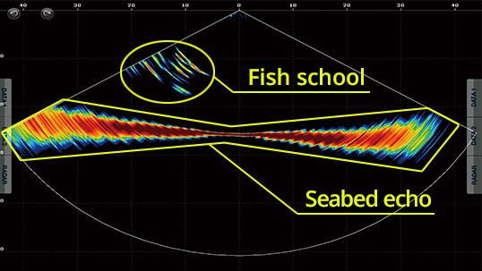
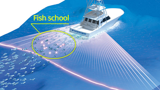
The cross-section view shows the real-time sea column echo spanning 120 degrees to both port and starboard. This feature helps quickly assess the distribution of bait fish and the state of the water column, with a detection range exceeding 200 meters, subject to variations in bottom, water, and installation conditions.
3D Sounder History
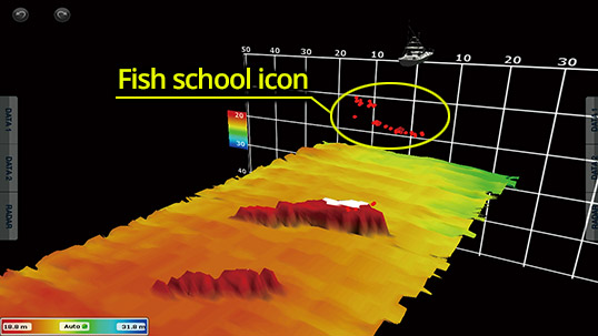
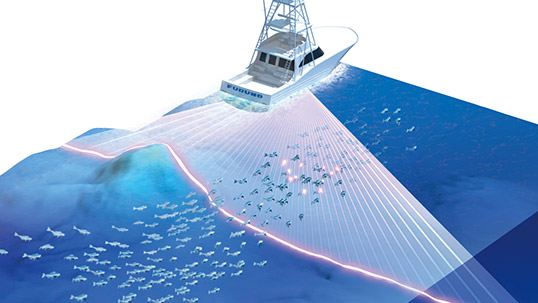
This mode offers a clear and straightforward 3D visualization of the ocean floor, complete with icons representing schools of fish. This feature is beneficial in numerous scenarios, including choosing a prime fishing location and evaluating the condition of the seabed.
Triple/Single Beam Sounder
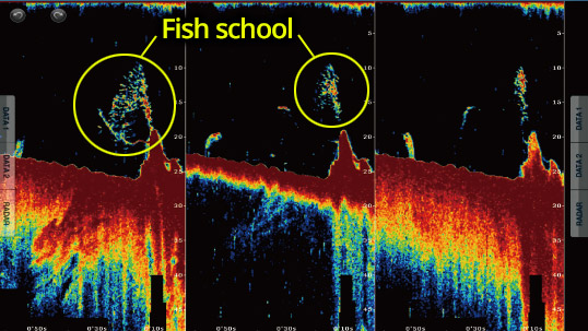
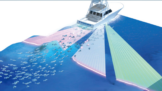
A fish finder image can be shown in either a single direction (directly beneath the boat) or in three directions (middle, left, and right) at the same time. The triple beam display provides insights into the depth of fish targets and the seabed conditions in each direction, as well as the movement direction of the target fish. Users can select the angle and width of each beam.
SIDE SCAN
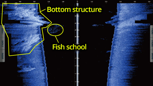
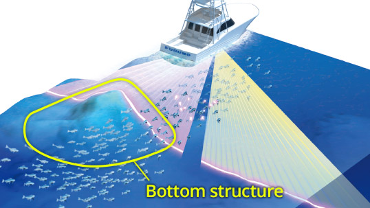
The side scan provides a high-definition image of the structure's shape in both port and starboard directions. It is ideal for exploring the seabed and analyzing the sea floor's structure. The detection range extends over 200 meters within a 120-degree arc from port to starboard, offering an unprecedented distance.
Sonar - Setting the Benchmark in Maritime Excellence
Furuno sonars set the standard in maritime sectors with their groundbreaking technologies, ensuring unparalleled accuracy and clarity. Renowned for their reliability, these sonars withstand harsh marine environments, providing consistent performance. Their advanced features enhance detection and sustainable fishing, making them indispensable for fishing vessels. Furuno's commitment to innovation and quality cements their leadership in sonar technology worldwide.
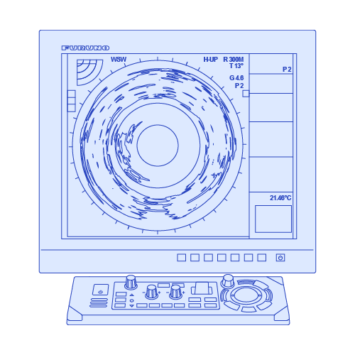
Fish Finder - Pioneer in marine electronics for fishing since 1948
Furuno has been a pioneer in marine electronics since 1948, consistently delivering unparalleled accuracy and reliability with their fish finders. Trusted by professionals and enthusiasts alike, Furuno's innovative technology ensures precise underwater detection, enhancing every fishing experience. With decades of expertise, Furuno continues to set the standard for dependable performance, making them the go-to choice for all users worldwide.
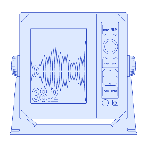
FURUNO MULTIBEAM technology
Products employing this (SONAR & fish finder) technology
These fish finders & sonars enable efficient fish location and seabed profile surveying.
Line of sight of a Radar
Radar waves propagate along Earth's surface, but due to diffraction effect, these waves propagate in a slightly curved manner. The degree of diffraction is determined by many factors including atmosphere density. In general, the diffraction curve allows the wave to go beyond the line-of-sight by about 6%
Radar waves propagate along Earth's surface, but due to diffraction effect, these waves propagate in a slightly curved manner. The degree of diffraction is determined by many factors including atmosphere density. In general, the diffraction curve allows the wave to go beyond the line-of-sight by about 6%


RADAR
Our radars deliver accurate images and reliability in all environments, combining superior performance with durability against harsh conditions.
SONAR
Our sonar technologies offer unparalleled accuracy and sustainability, ensuring optimal performance and eco-friendly practices for all fishing vessels.
FISH FINDER
Furuno's fish finder technologies have revolutionized fishing, offering unparalleled accuracy and reliability since their inception.
AUTOPILOT
Furuno's autopilot technologies enhance navigation safety and precision through advanced algorithms, real-time adjustments, and user-friendly interfaces.
CHARTPLOTTER
Our chartplotter technologies enhance maritime safety and simplify navigation by providing real-time data, precise positioning, and the best marine charts.
USER INTERFACE
User interface technologies simplify marine instrument operation, enhancing navigation efficiency and safety with intuitive, user-friendly controls.
Line of sight of a Radar
Radar waves propagate along Earth's surface, but due to diffraction effect, these waves propagate in a slightly curved manner. The degree of diffraction is determined by many factors including atmosphere density. In general, the diffraction curve allows the wave to go beyond the line-of-sight by about 6%
D=2.2(√H1 + √H2)
D: Radar line-of-sight (NM)
H1: Altitude at which the Radar is installed (m)
H2:Altitude of the object reverberating the signal (m)
RADAR PRODUCTS
Contact one of our departments to solve your problem
ACCESORIES
Contact one of our departments to solve your problem


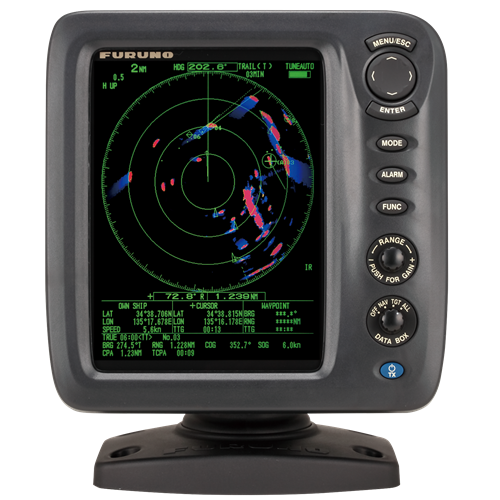
1815
€120
VAT Included (20%)

1815
€120
VAT Included (20%)

1815
€120
VAT Included (20%)

1815
€120
VAT Included (20%)

1815
€120
VAT Included (20%)

1815
€120
VAT Included (20%)