


SOFTWARE
Model TZ PROFESSIONAL
The ultimate navigation solution for professionals who demand excellence at sea!
TZ PROFESSIONAL is advanced marine navigation TIMEZERO software for professional mariners, offering chart plotting, weather forecasts, and full integration with FURUNO instruments.
REF: MAX-TZPRO
TZ PROFESSIONAL


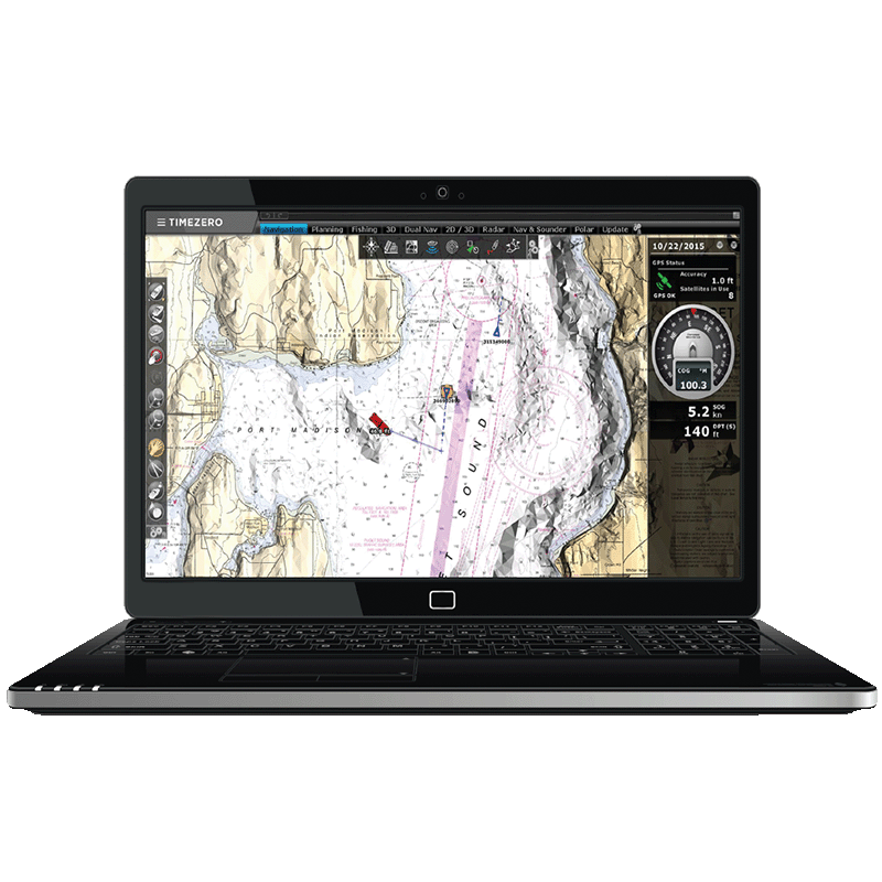
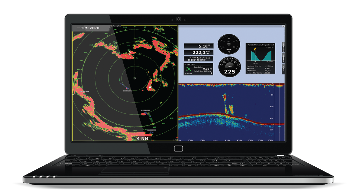
Advanced TIMEZERO Chart Display
The TIMEZERO Chart Engine delivers a smooth and seamless chart display with no redraw time, whether you are working in 2D or 3D. Its exclusive PhotoFusion technology blends high-resolution satellite photos with raster or vector charts to improve coastal detail and readability. Land areas are shown using satellite imagery, while deeper waters reveal underlying chart information, ensuring clear and intuitive visualisation for professional navigation.
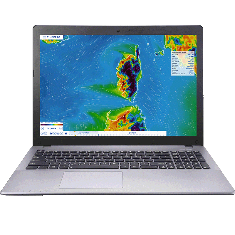
Marine Weather & Forecast Tools
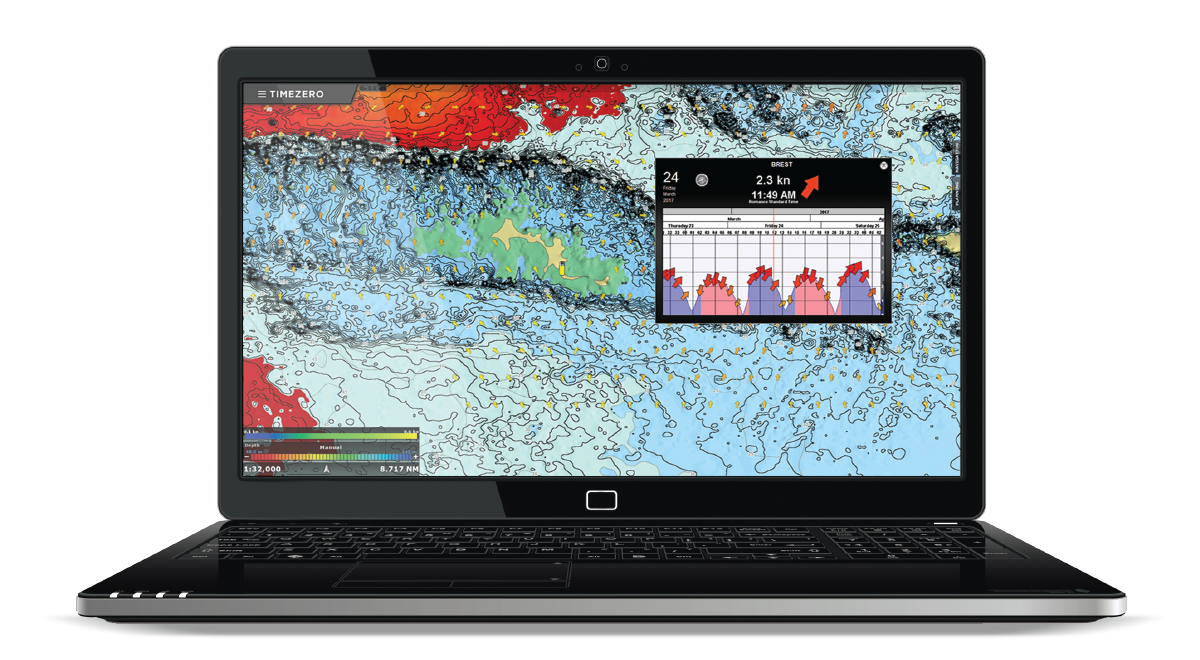
TZ Professional includes a built-in weather data service offering free worldwide forecasts (wind, waves, pressure, rain, clouds, temperature) up to 15 days ahead. Forecasts data can be downloaded via internet, Iridium Go or email, then displayed and animated directly on charts. This helps captains anticipate changing conditions, plan safer passages and make informed decisions when navigating coastal or offshore waters.
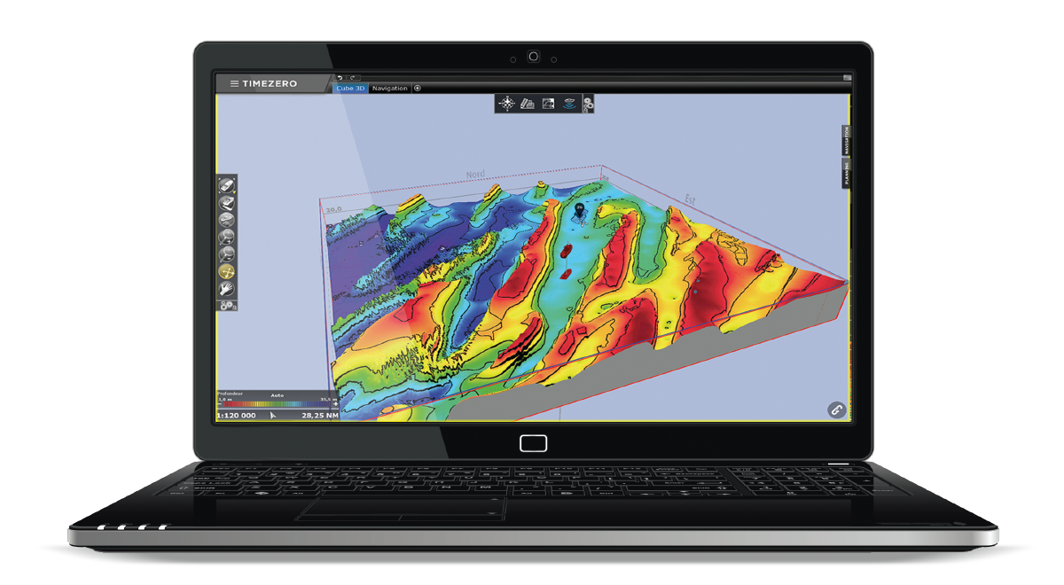
2D Seabed Profile Window
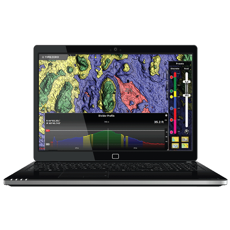
The Profile Window in TZ PROFESSIONAL displays a 2D depth-profile view along any previously recorded track or drawn divider line—using chart or 3D database bathymetry data. As you move the cursor over the profile, the corresponding location is shown on the chart, and you can add marks directly from the profile view. This tool helps you inspect seabed variations with high precision, revealing hazards such as wrecks or rocks and supporting safer navigation planning.
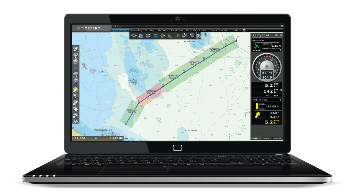
Advanced Professional User Interface
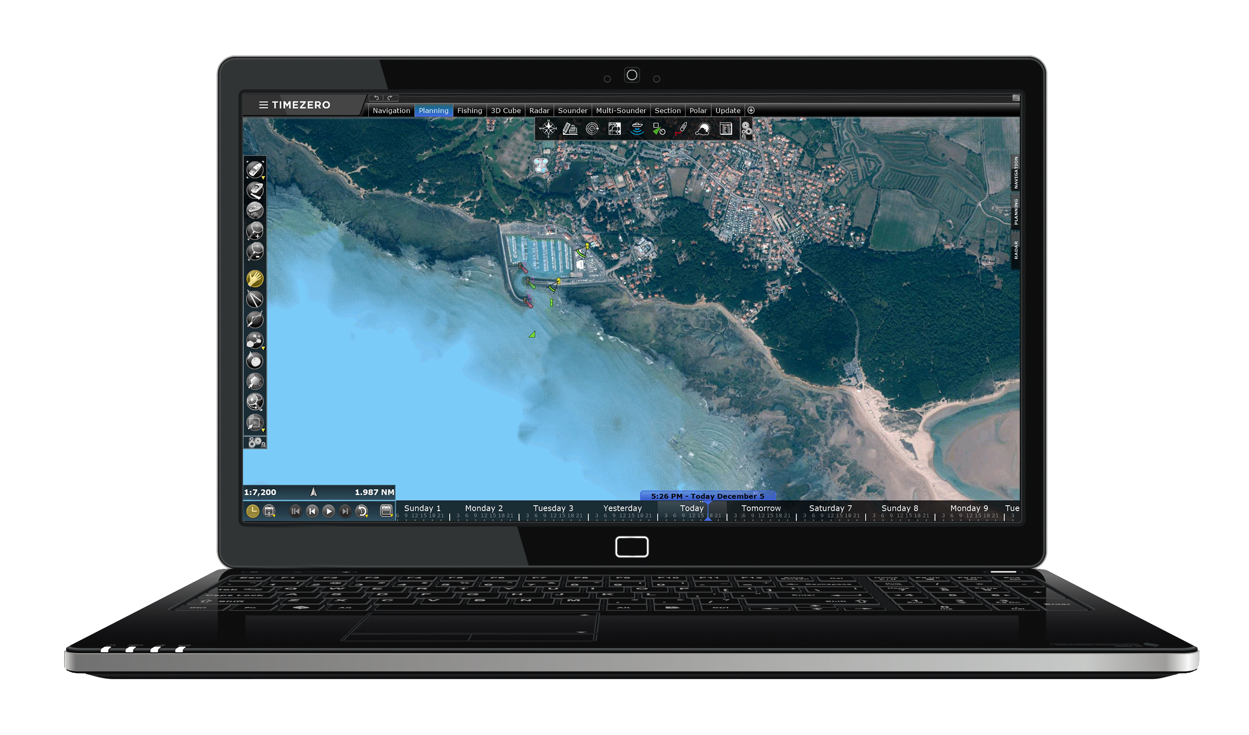
TZ PROFESSIONAL features an advanced, intuitive user interface designed for professional maritime navigation. With customizable workspaces, toolbars, ribbons and NavData panels, you can adapt the layout to your workflow and quickly access core data. The interface includes day, dusk and night modes for optimal readability in any lighting. Workspace configurations can be saved and recalled, ensuring efficient navigation management across missions or vessels.
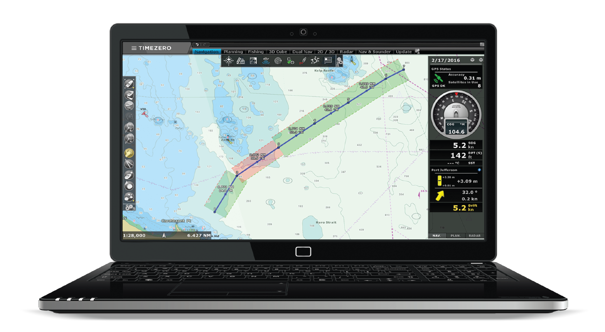
Route Planning and Safety Check
TZ PROFESSIONAL provides complete route management tools that allow you to create, edit and organize routes directly on the chart. Users can view tide and current information along the route to help select the best departure time. A safety check highlights each leg in green or red according to depth limits you define, making it easy to identify unsafe areas and plan passages with greater confidence for professional navigation.
Fishing Workspace
The Fisheries workspace in TZ PROFESSIONAL provides a dedicated layout optimized for fishing operations, offering rapid access to depth shading, contour lines, and bathymetric settings.
Simplified tools on the right-hand side allow users to toggle depth or hardness shading, terrain shading, and contour lines, as well as switch between display modes (Auto, Manual, or Discrete) to enhance seabed features.
This workspace streamlines seabed visualisation and data overlay, improves bottom analysis, and supports more efficient identification of fishing areas.

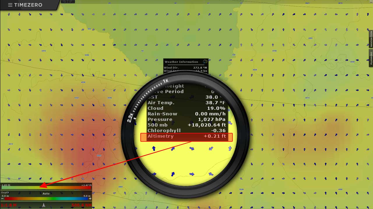
Ocean-O Marine Forecast Layers
The Ocean-O service in TZ PROFESSIONAL provides access to oceanographic forecasts that can be downloaded and displayed directly on your charts. It offers essential data such as altimetry, sea surface temperature and ocean currents to help you monitor large-scale ocean conditions. With these regularly updated layers, you can better understand water movements and temperature patterns, supporting safer decisions and more informed navigation during offshore operations.
AIS/ARPA Real-Time Target Display
The AIS/ARPA Targets feature in TZ PROFESSIONAL receives and displays AIS and ARPA signals (via NMEA 0183 or Ethernet radar) directly on the chart and in detailed target lists. You can record unlimited AIS/ARPA tracks, monitor key data such as speed, heading, CPA and TCPA, and set anti-collision alarms. This real-time vessel-tracking capability greatly enhances situational awareness and supports safer operations in busy or restricted navigation areas.

Secure Cloud Sync Across Platforms
TZ PROFESSIONAL supports the TZ Cloud service, which automatically saves and synchronizes your navigation data—such as routes, marks, boundaries, annotations and photos—whenever an Internet connection is available. This real-time synchronization keeps your information securely backed up and shared across all TIMEZERO platforms and compatible FURUNO NavNet TZtouch MFDs, ensuring continuous access to your essential navigation data across devices.

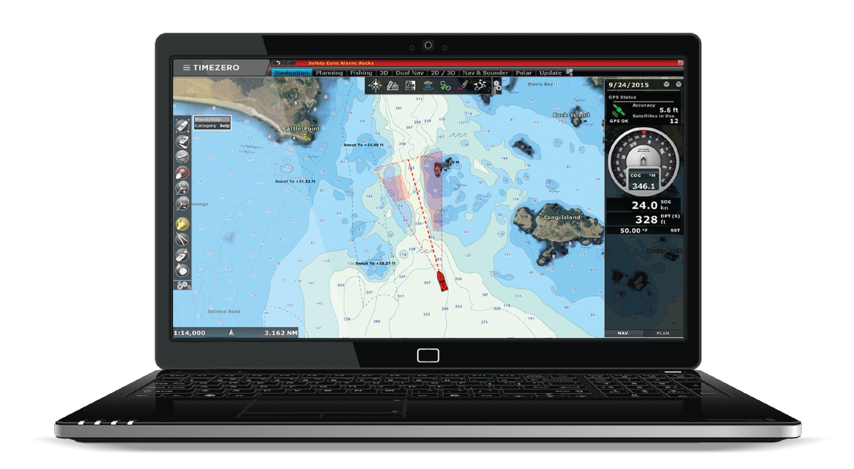
Security Cone Depth Awareness
Security Cone in TZ PROFESSIONAL displays a visual under-keel safety zone based on your vessel’s draught, extending ahead of your course to highlight safe water depths. As you move, the cone overlays your chart, making it easy to spot shallow or risky areas before you enter them. This feature enhances navigational safety by helping prevent groundings and ensuring clear under-keel clearance at all times.

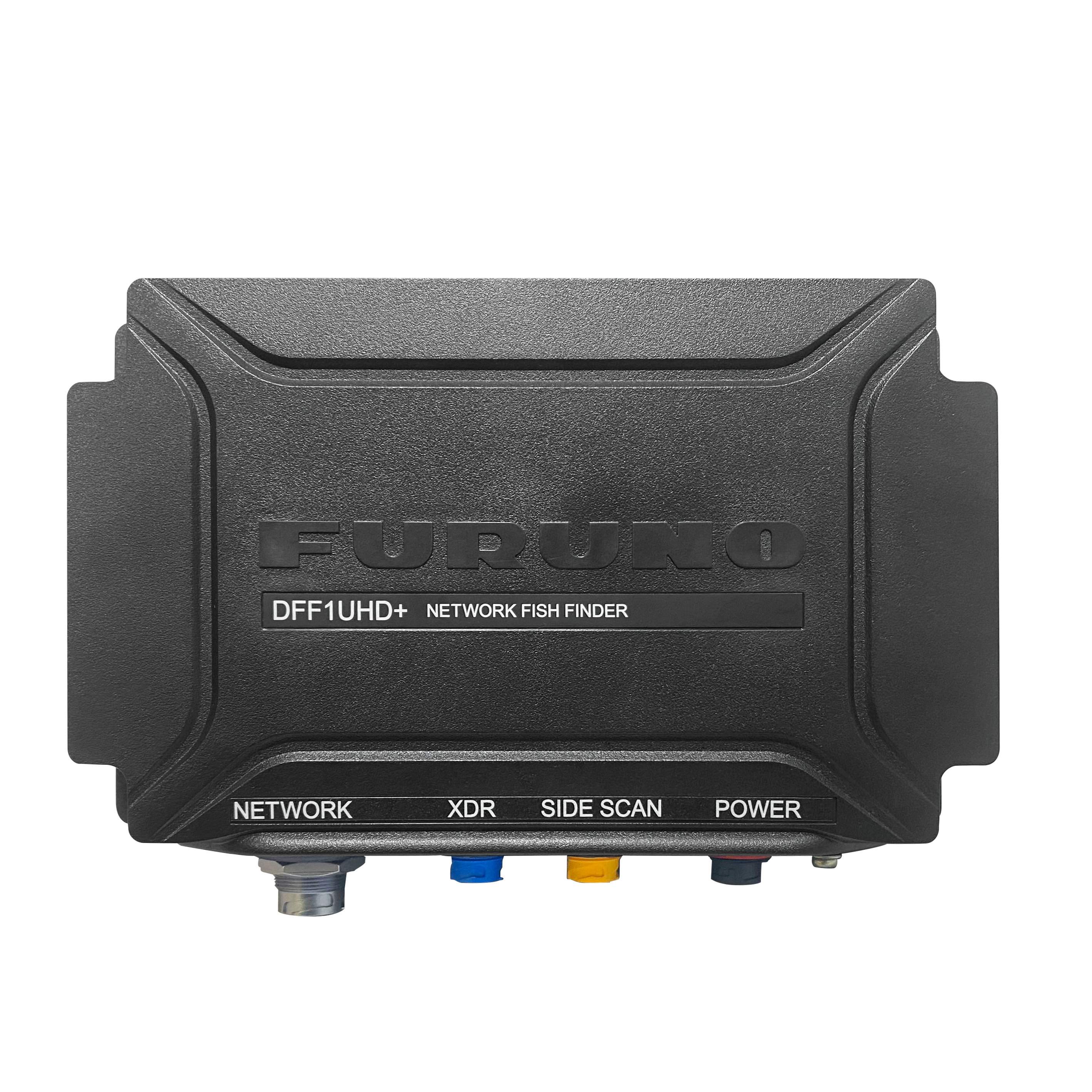
TIMEZERO now fully compatible with Furuno DFF1‑UHD+
TIMEZERO (from version 5.4) brings full support for the new Furuno DFF1‑UHD+, delivering ultra‑high‑definition sonar, improved target separation, and detailed seabed imaging across TZ Professional and TZ Navigator.
Download all the necessary documents
High-fidelity wireframes are often used for documenting because they incorporate.

Product Advantages
Designed for Professional Mariners: Tailored to meet the navigation needs of commercial fishing, workboats, racing, and sport fishing.
Cutting-Edge Technology: Combines supreme control and performance for demanding operations at sea.
Compatibility with Official S-63 Charts: Ensures up-to-date, encrypted charts following IMO standards for maximum safety.
Advanced Route Management: Simplifies planning and monitoring of navigation routes.
Dedicated Workspaces: Customizable interfaces for different activities and workflows.
Multi-Monitor Support: Up to 3 independent workspaces across multiple screens for enhanced productivity.
Real-Time AIS & ARPA Target Tracking: Improves situational awareness and collision avoidance.
Weather & Ocean Data Integration: Access premium weather forecasts and oceanographic data for optimal decision-making.
Cloud Synchronization: Seamless data sharing and backup across devices.
Modular Architecture: Expand capabilities with specialized modules (e.g., Furuno Sounder, Multibeam, Trawl Positioning, Radar, Augmented Reality).
Fishing-Specific Tools: Includes PBG, bottom hardness analysis, and trawl positioning for commercial fishing operations.
TIMEZERO v5.4 Now Fully Compatible with Furuno DFF1‑UHD+
High Performance Chart Engine: Fast and smooth chart rendering for efficient navigation.
Security Features: AIS security cone for enhanced safety monitoring.
User-Friendly Interface: Intuitive design for easy management of navigation data and instruments.
Comprehensive Support: Access to curated manuals and user guides for reliable operation and safety.
Fully Compliant with New ECS Regulations including USCG NVIC 01-16 CHG 3, RTCM-SC109, and UK MCA’s SV-ECS framework.
