PBG
This technology detects and draws bottom structures, clearly revealing terrain, fishing spots, and ridges for easy interpretation.
What is PBG?
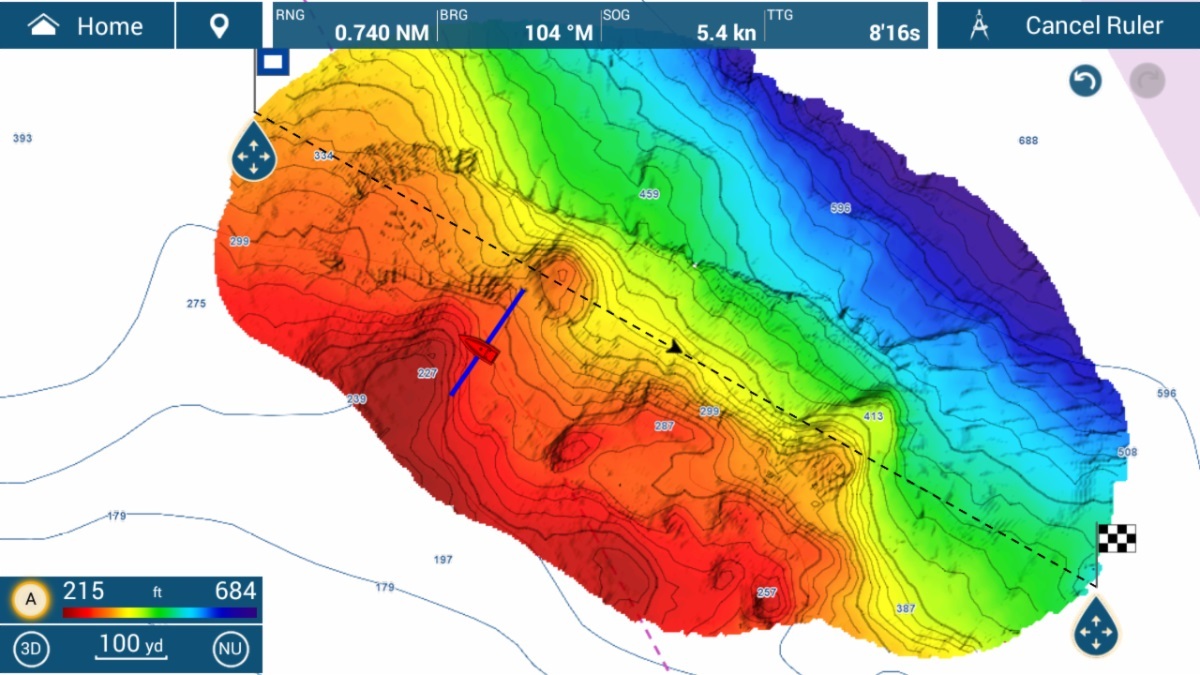
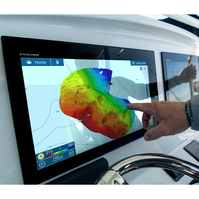
PBG technology generates real-time bottom images using shaded relief, depth contours, and colors to uncover hidden structures and ridges, assisting in fish identification.
Furuno's bottom mapping technology allows you to swiftly generate Shaded Relief Maps using NavNet TZtouchXL and the DFF-3D multibeam sounder.
These maps feature shaded relief, depth contours, and color variations, simplifying the identification of fish-holding structures.
Multiple color palettes are available, including options to display only contour lines for clarity.
FURUNO TECHNOLOGY
Senior Engineer
at Furuno
"The Personal Bathymetric Generator technology is a game-changer in marine exploration. Its precision in revealing intricate seafloor structures significantly enhances our ability to interpret the ocean bottom, providing invaluable insights for better fishing experiences and navigational safety."

Color Pallet Options
A total of six (6) options of depth color pallets are available.
Shaded Relief Settings
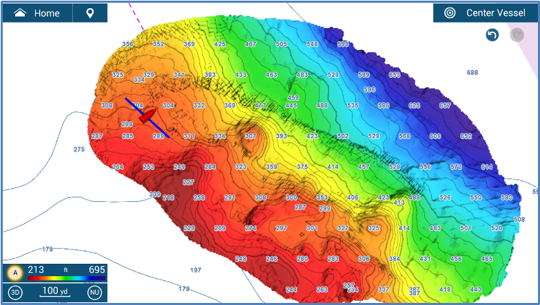
PBG can be shown with Shaded Relief for more detail. The Light or Medium setting is recommended to enhance the PBG details.
Displaying Depth Contour Only
PBG color and Shaded Relief help identify depths, but contour lines are useful when shading obscures chart points.
Integrating advanced motion sensors for PBG SAT COMPASS
For the highest PBG accuracy, a compatible motion sensor with heave correction is recommended. A Furuno SCX20 or SC33 SATELLITE COMPASS™ is recommended over the DFF3D’s internal built-in transducer motion sensor. The following table content is based on the condition that a SATELLITE COMPASS™ such as SCX-20 and SC-30/33 is used as the source of position, heading, and motion sensor. Use of a Satellite Compass to improve PBG accuracy requires setting the correct transducer and satellite compass installed position offset values.
Enhanced Underwater Mapping
Furuno's PBG technology revolutionizes underwater mapping by providing highly detailed and accurate bathymetric data. This advanced system allows users to generate precise high-resolution maps of the seafloor, which are crucial for various maritime activities such as navigation, fishing, and scientific research. The ability to visualize underwater topography in such detail enhances safety and efficiency, enabling mariners to avoid underwater hazards and optimize routes. Instead of just one depth point per ping like some competitor systems, this technology provides 50 depth points. This level of precision is particularly beneficial for industries that rely on accurate seafloor data, ensuring operations are conducted with the highest level of confidence and reliability.
User-Friendly Interface
Furuno's PBG technology is designed with a user-friendly interface that simplifies the complex task of bathymetric mapping. The intuitive design ensures that even users with minimal technical expertise can effectively operate the system and interpret the data. This accessibility broadens the technology's applicability, making it a valuable tool for a wide range of users, from professional mariners to recreational boaters. By lowering the barrier to entry, Furuno's PBG technology empowers more individuals and organizations to harness the power of detailed bathymetric data, fostering a deeper understanding of underwater environments and promoting safer maritime activities.
Real-Time Data Processing
One of the standout benefits of Furuno's PBG technology is its capability for real-time data processing. This feature allows users to receive immediate feedback and make on-the-fly adjustments during operations. Whether it's for fishing, where understanding the seafloor can lead to more productive catches, or for scientific expeditions that require immediate data analysis, the real-time processing capability ensures that users have the most current information at their fingertips. This immediacy not only enhances decision-making but also reduces the time and resources spent on post-processing, making operations more efficient and cost-effective.
/file%20(6).jpg?width=510&height=765&name=file%20(6).jpg)
Fish Finder - Pioneer in marine electronics for fishing since 1948
Furuno has been a pioneer in marine electronics since 1948, consistently delivering unparalleled accuracy and reliability with their fish finders. Trusted by professionals and enthusiasts alike, Furuno's innovative technology ensures precise underwater detection, enhancing every fishing experience. With decades of expertise, Furuno continues to set the standard for dependable performance, making them the go-to choice for all users worldwide.
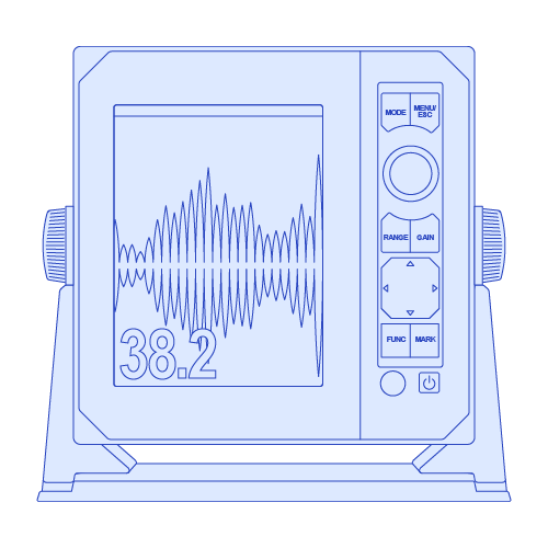
PBG (Personal Bathymetric Generator)
Draw your own shaded relief maps
D=2.2(√H1 + √H2)
D: Radar line-of-sight (NM)
H1: Altitude at which the Radar is installed (m)
H2:Altitude of the object reverberating the signal (m)
Products employing this radar technology
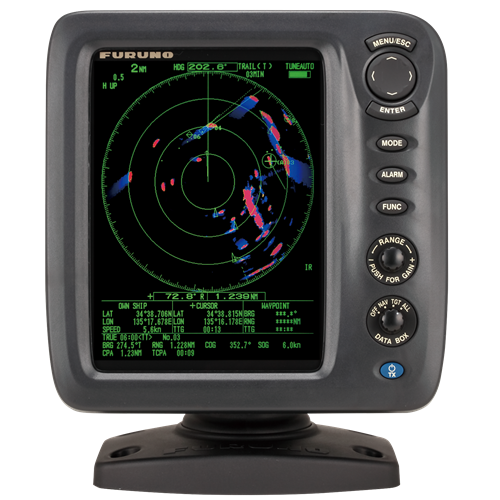
These radars were developed to guarantee situational awareness as they reliably and intuitively track dangerous targets.
Products employing this fish finder technology
These fish finders deliver the ability to draw bottom relief maps with incredible accuracy.


RADAR
Our radars deliver accurate images and reliability in all environments, combining superior performance with durability against harsh conditions.
SONAR
Our sonar technologies offer unparalleled accuracy and sustainability, ensuring optimal performance and eco-friendly practices for all fishing vessels.
FISH FINDER
Furuno's fish finder technologies have revolutionized fishing, offering unparalleled accuracy and reliability since their inception.
AUTOPILOT
Furuno's autopilot technologies enhance navigation safety and precision through advanced algorithms, real-time adjustments, and user-friendly interfaces.
CHARTPLOTTER
Our chartplotter technologies enhance maritime safety and simplify navigation by providing real-time data, precise positioning, and the best marine charts.
USER INTERFACE
User interface technologies simplify marine instrument operation, enhancing navigation efficiency and safety with intuitive, user-friendly controls.
ACCESORIES
Contact one of our departments to solve your problem


1815
€120
VAT Included (20%)

1815
€120
VAT Included (20%)

1815
€120
VAT Included (20%)

1815
€120
VAT Included (20%)

1815
€120
VAT Included (20%)

1815
€120
VAT Included (20%)