AR Navigation System
A revolutionary navigation and maneuvering support system for ships that takes full advantage of Augmented Reality technology.
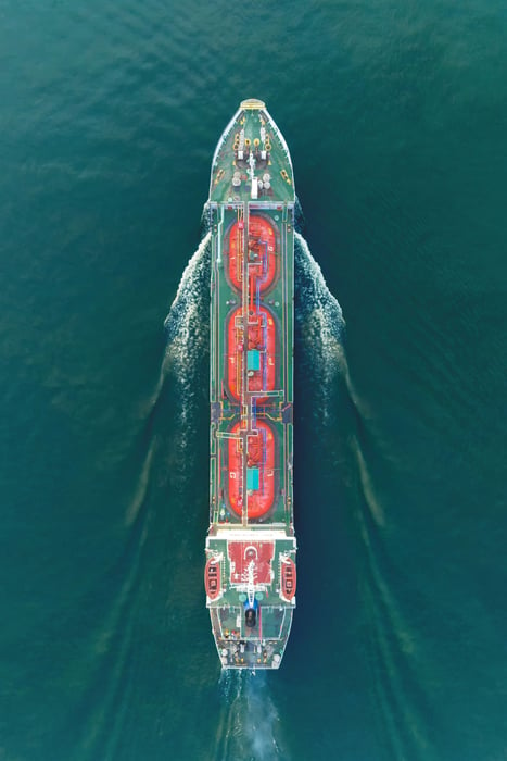
Revolutionizing navigation: Furuno augmented reality solution enhances safety and autonomy
The FURUNO ENVISION AR Navigation System is an innovative augmented reality navigation tool designed to significantly enhance navigation by leveraging AR technology to transcend traditional boundaries. The FURUNO ENVISION series is dedicated to improving voyage safety and security by providing visual assistance for maneuvering and navigation in all operations, marking a technological advancement towards autonomous navigation.
FUNDAMENTALS OF AR NAVIGATION SYSTEM
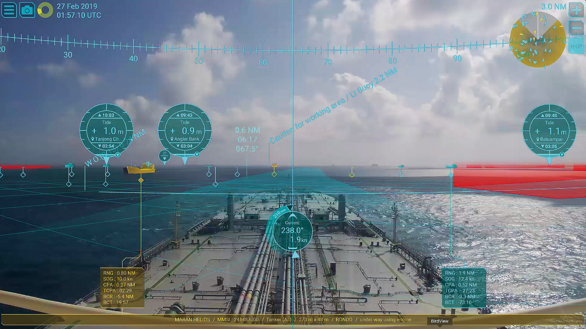
A forward-facing camera on the vessel captures an image that is displayed with all necessary navigation information overlaid using our AR technology. This setup allows you to see other vessels' routes and essential data, as well as your own ship's information, even in poor weather or low visibility, ensuring stress-free maneuvering and navigation.
This intuitive method of displaying and sharing information between the captain and the bridge team enhances situational awareness, boosts crew confidence, supports the watchman, and improves crew coordination.
Note: AR navigation is an auxiliary tool meant to enhance navigation comfort for safer travel. It should never replace Radar, ECDIS, or other essential instruments for avoiding danger.
KEY BENEFITS OF FURUNO'S AUGMENTED REALITY NAVIGATION SYSTEM
Furuno's Augmented Reality (AR) navigation system offers a transformative approach to maritime navigation, providing commercial vessels with a suite of advanced features that enhance safety, efficiency, and situational awareness.
Enhances Navigational Safety Visibility
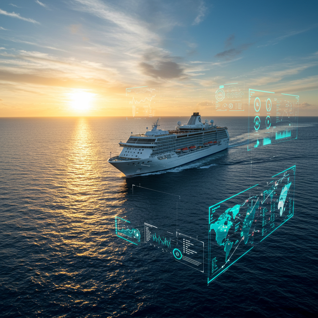
The AR solution enables the overlay of critical navigational data directly onto real-world views, allowing operators to make informed decisions quickly. This integration of digital information with the physical environment helps identify potential hazards, such as other vessels or obstacles, even in poor visibility conditions.
Reduces the cognitive load on operators
By presenting essential data in a clear and intuitive manner, the Augmented Reality navigation system minimizes the need for constant cross-referencing between different instruments, thus reducing the risk of human error. The system also supports route optimization by providing real-time updates and predictive analytics, which can lead to significant fuel savings and reduced operational costs.
Improves communication and coordination among crew members
By providing a shared visual context, Furuno's solution facilitates better teamwork and decision-making, especially in complex or high-pressure situations. This collaborative advantage is crucial for maintaining safety standards and ensuring smooth operations on commercial vessels.
Furuno's Augmented Reality navigation system offers commercial vessels a cutting-edge tool that not only improves navigational accuracy and safety but also boosts operational efficiency and crew collaboration.
Chief Engineer Autonomous Navigation Technology Development Department at Furuno
"The AR Navigation was designed to support intuitive situational awareness during navigation by combining crucial navigational information such as Radar and ECDIS on camera image. The support system will realize the reductions of both work burden and oversight for navigators, ensuring safe and comfortable navigation."
AR OVERLAY
With a forward-facing camera on the vessel, a live video feed of the front view is displayed, enhanced with essential navigation data overlaid using Furuno AR technology.
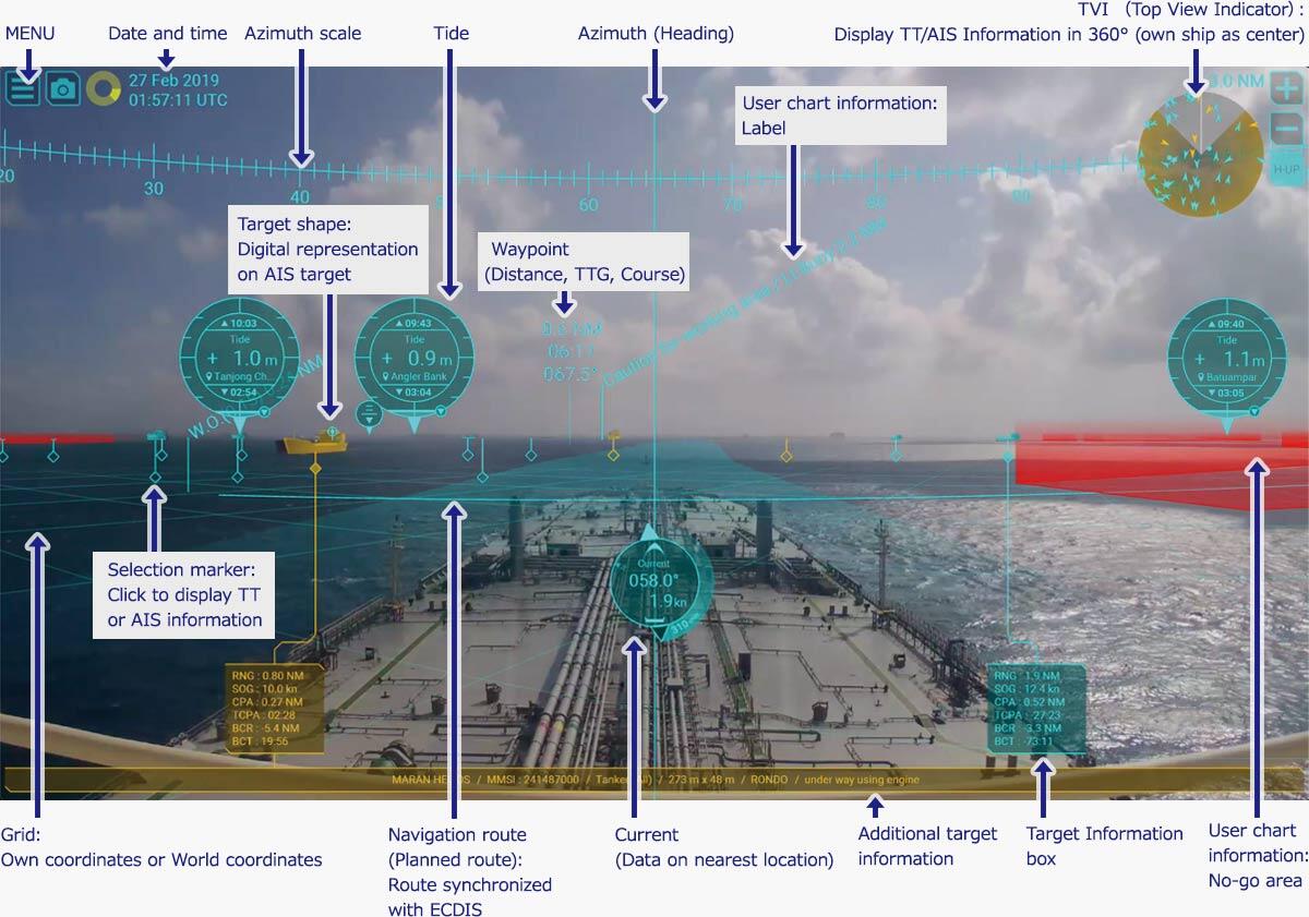
TVI (Top View Indicator)
Displays other ships by either Target Tracking (TT) or AIS in 360 degrees with own ship as center.
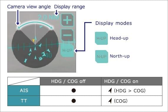
If the target is out of the viewing angle of the camera, the out-of-view area in the TVI will flash to alert you.
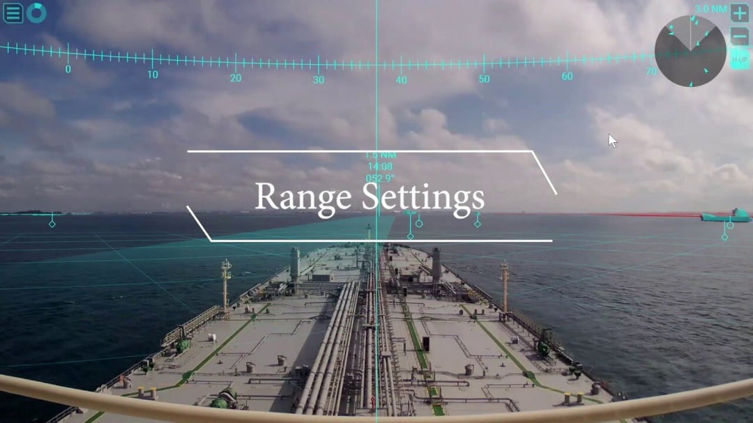
One-click range switching
In busy maritime areas with numerous ships, adjusting the range can help minimize the number of visible targets. This feature is also beneficial for briefly monitoring far-off targets.
Intuitive color-coded display for targets*
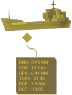
Utilizing CPA/TCPA values, TT and AIS targets will be color-coded to indicate their threat levels.
- TVI
- Selective marker
- Primary target data display
- Supplementary target data display
- Target shape
*Color options include Yellow, Orange, and Red, and can be customized.
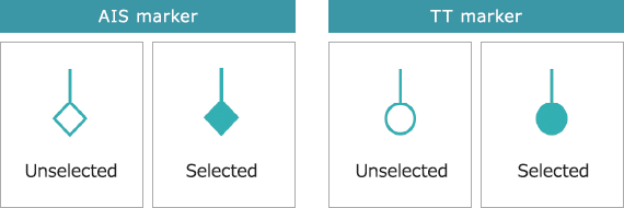
Selection marker and Target information box
Ship details gathered through TT or AIS are represented by specific marks. Clicking a mark will display a box with the relevant information.
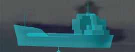
Target shape
Overlaying the graphical virtual shape onto AIS targets (such as virtual buoys, buoys, boats, and tankers) allows for an intuitive understanding of the positions and trajectories of hazardous targets.
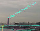
User can show/hide the information
The user has the option to display or hide details such as the course to the next waypoint, the time remaining, and the distance to the next waypoint on the route.
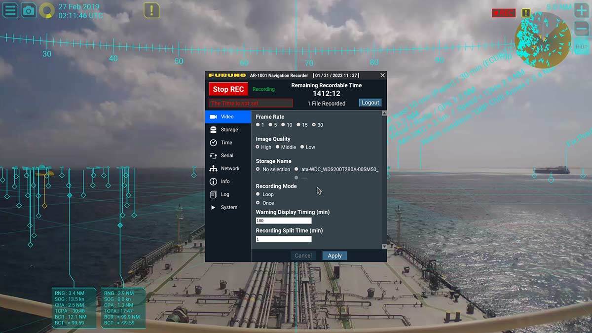
Navigation data recording function (option)
Coming soon
By capturing navigation data onto an external USB device*, incidents at sea can be reviewed and transformed into training resources for crew training.
*Customer supply
Enhancing Visibility with AR Information Overlays
AR Navigation ON/OFF Comparison in bad weather conditions


AR Navigation ON/OFF Comparison during nighttime navigation
Our AR Navigation system enhances situational awareness by integrating augmented reality data with live footage from a surveillance camera, providing users with a fast and intuitive understanding of their surroundings.

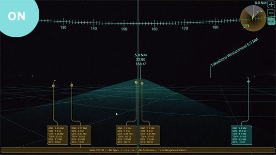
STABLE AR EXPRESSION
Regardless of the ship's pitching or rolling, the overlaid augmented reality information stays steady and aligned with the actual elements in the live imagery, ensuring dependable data under all conditions.
FURUNO ENVISION AR NAVIGATION SYSTEM PRESENTATION
INTERCONNECTION DIAGRAM
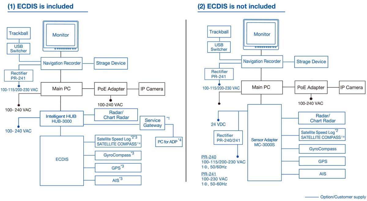
*1 Needed for displaying UKHO®ADP chart.
*2 The level of pitch, roll and yaw compensation may vary depending on the performance and data conversion rate of the connected equipment.
*3 When 3 or more instruments are connected to the FMD-3100, the sensor adapter MC-3000S is required.
*4 Windows 10®, Microsoft NET Framework® v4.0, LAN pot, FURUNO CAST ADP software, UKHO® ADP software installation and a valid license are needed.
ESSENTIAL DOWNLOADS
Here you can find all relevant information about this topic.
Contact us for all inquiries regarding our AR Navigation System.
- ALL
- ONSHORE
- OFFSHORE
