Our advanced radars monitor and analyze weather and objects using specialized signal processing technology.
Learn how our solutions meet the unique needs of various industries worldwide.
Experience our comprehensive services, ensuring your operations run smoothly.
Dive into the future with our state-of-the-art technologies leading the industry.
Get the latest updates, insights, and resources to keep you ahead of the curve.
Explore our cutting-edge products designed to enhance your experience and efficiency.
Find customized solutions that address your specific challenges with precision.
Voyage Planning System
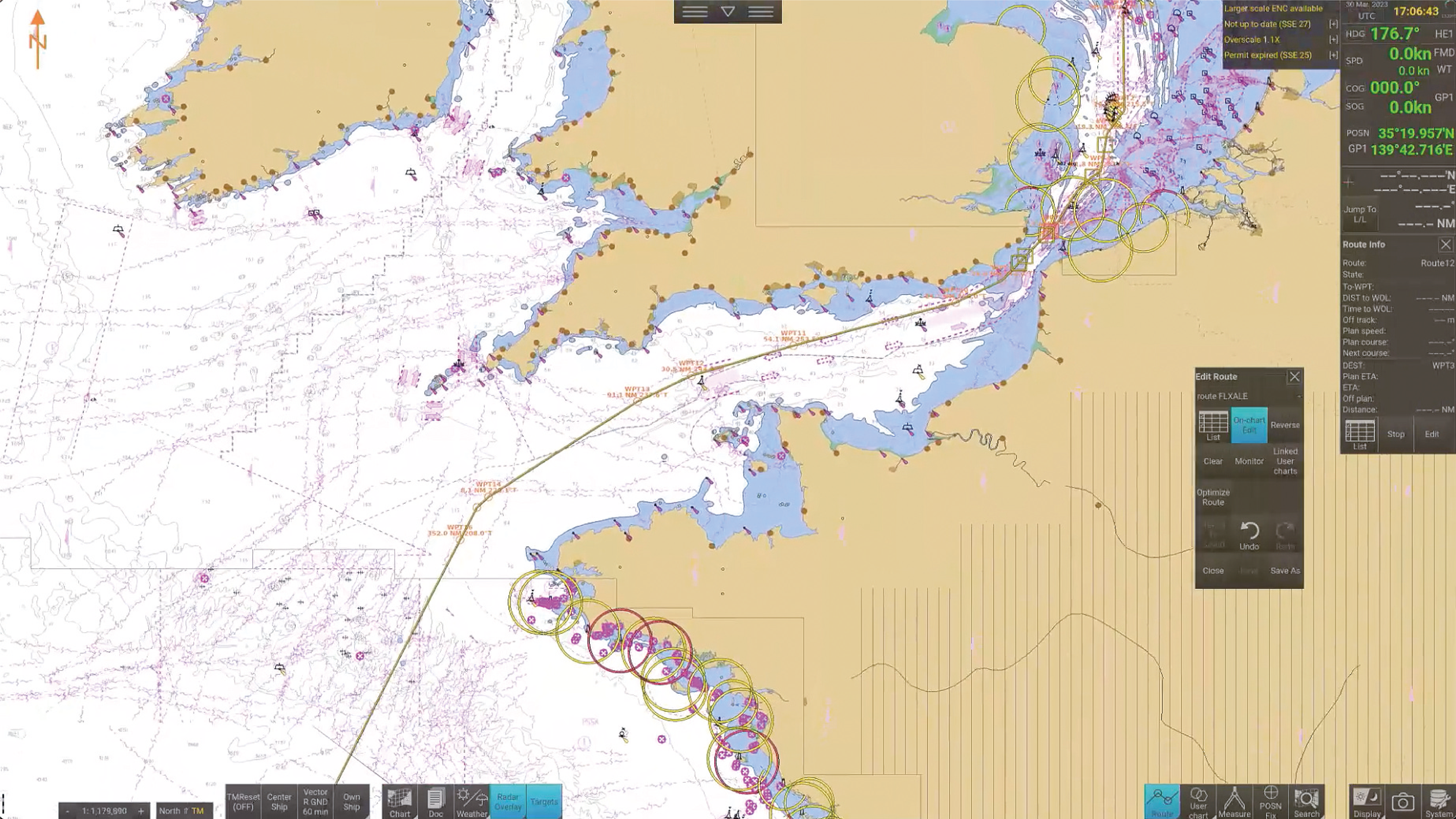
Route Creation and Editing
Easily design and modify routes with simple screen taps, adding new points, lines, and areas as needed.
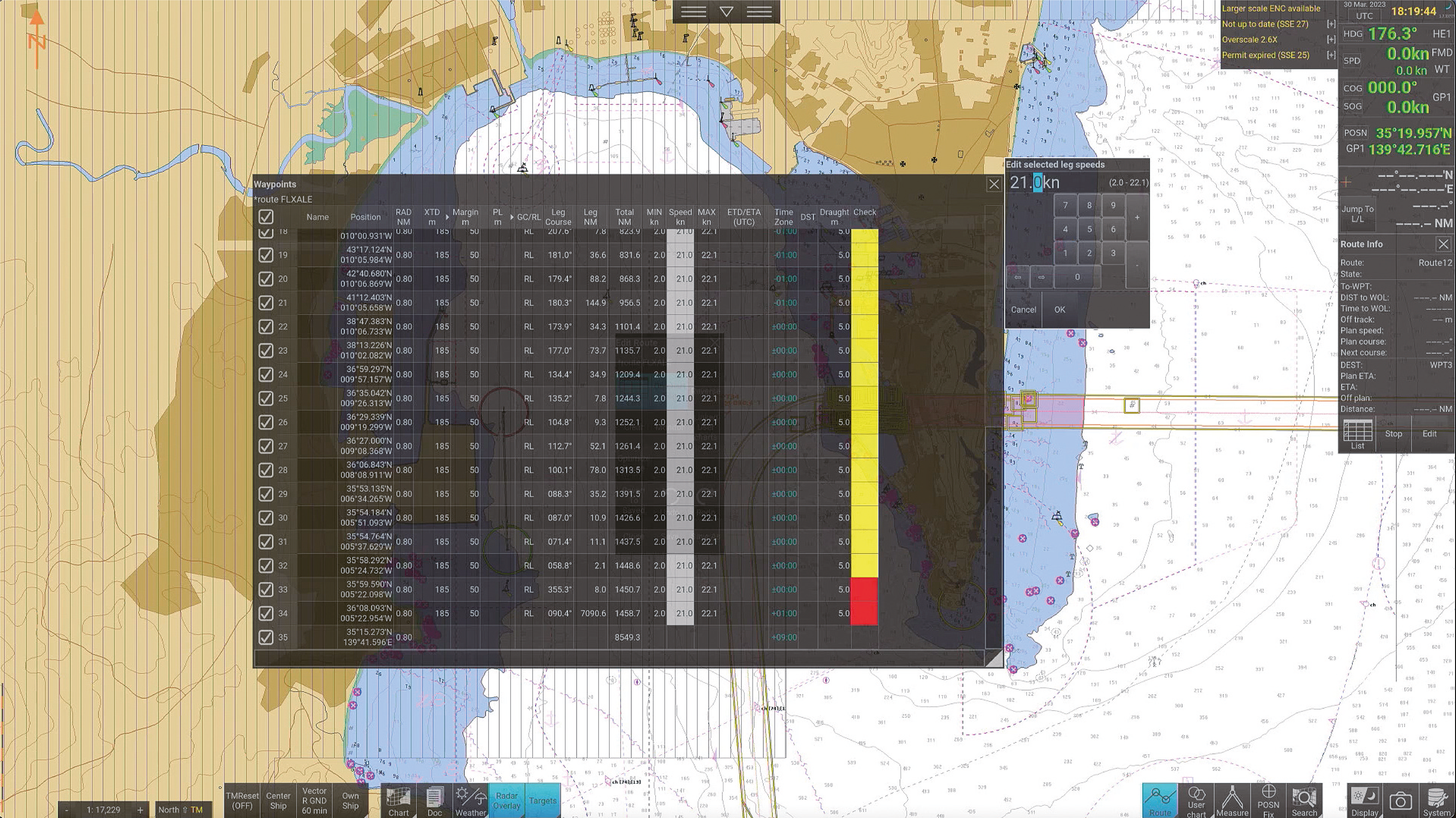
Ship Speed Calculation
Automatically determine recommended ship speeds by setting ETD/ETA for each waypoint, with color-coded route analysis results for quick assessment.
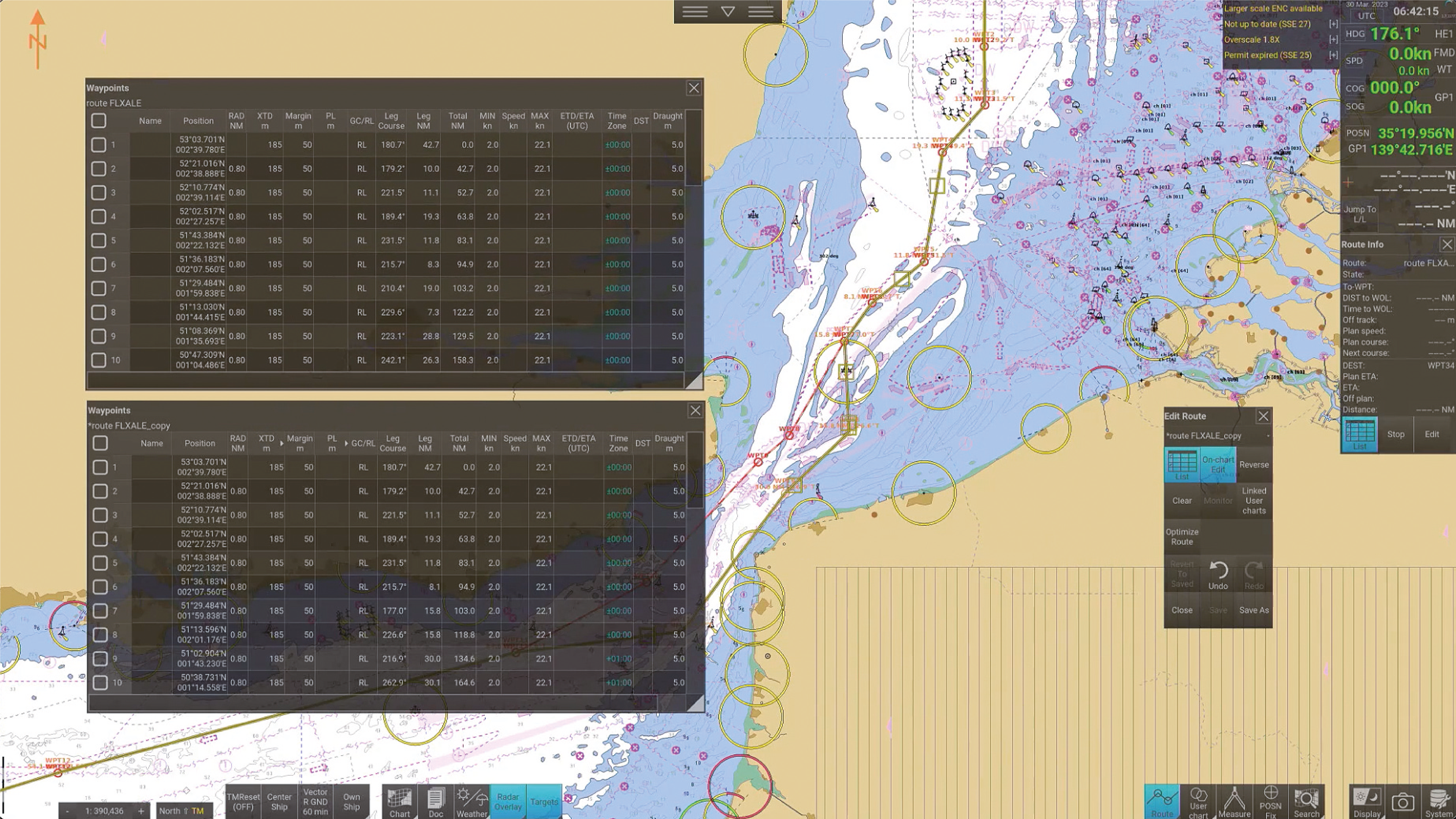
Route Comparison and Playback
Compare multiple routes, including past and current options, to facilitate crew communication and decision-making.
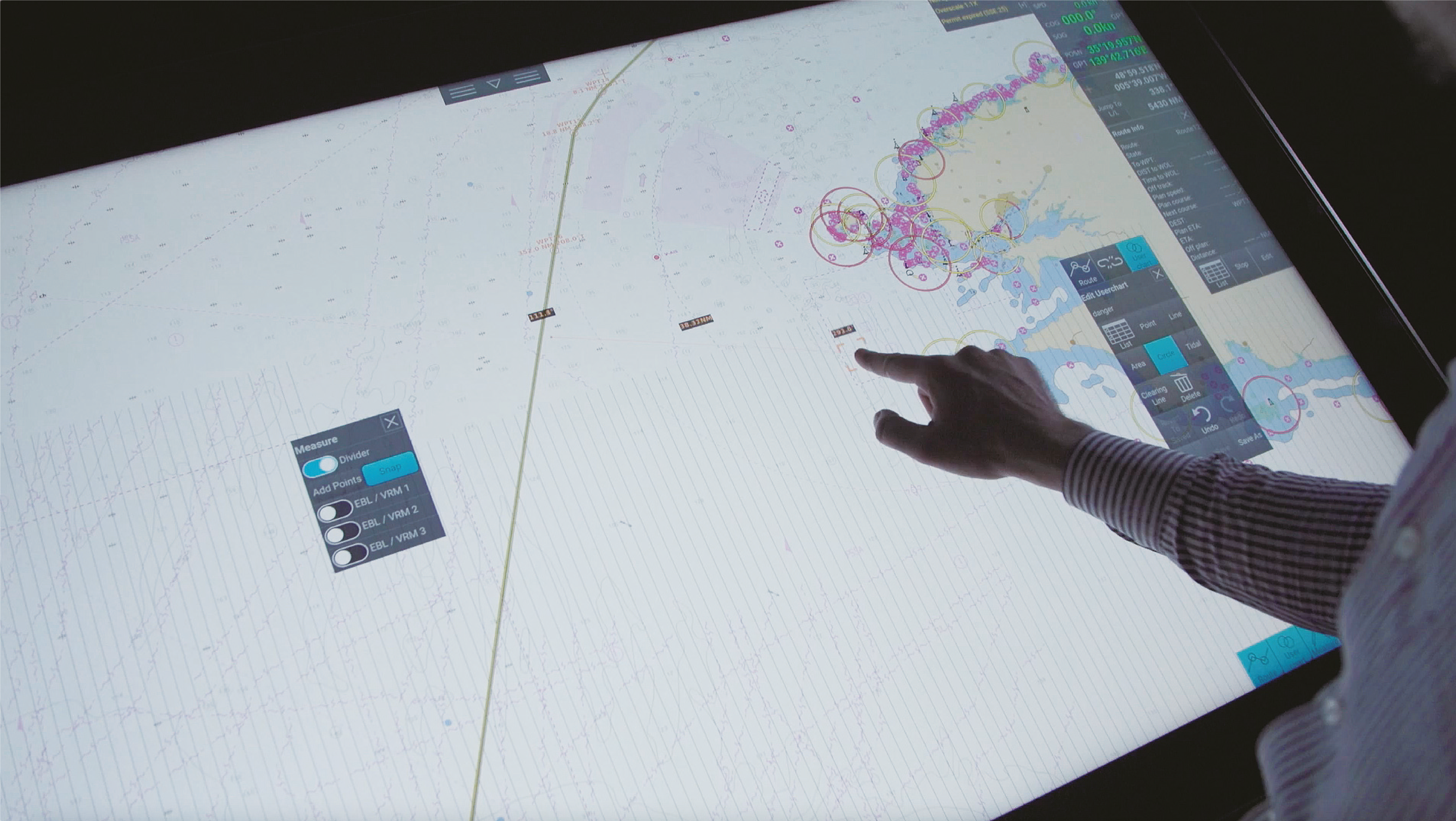
Distance Measurement Tools
Utilize the divider and EBL/VRM sets for precise distance and bearing measurements.
Comprehensive Sensor Data
Access real-time heading, speed, and position data on the ENC chart, with automatic voyage log recording.
Radar and Target Information
Overlay radar images and AIS target data for enhanced situational awareness, requiring network integration with ECDIS and radar systems.
Weather Data Integration
Import and overlay weather information using grib1 files for informed navigation decisions.
Routes and user charts created with the PS-100 and ECDIS can be shared between units. Data that is created or modified is automatically distributed to other units, eliminating the need for manual data migration.
*ECDIS, radar, and AIS receiver must be connected to the same network.
FMD-3100/3200/3300, FAR-3xx0 (version 5.03 or later)
Call the same Circle from ECDIS created by PS-100.
Shareable Data
• Charts
• Route files
• User chart
• Own ship parameters
• Sensor information used by ECDIS
• Radar overlay
• Own ship setting
• Voyage log.
Enhanced Safety
Furuno's voyage planning solutions prioritize safety by providing accurate and up-to-date navigational data, helping to avoid potential hazards and ensuring a secure journey.
Fuel Efficiency
By optimizing routes and minimizing unnecessary detours, the Voyage Planning system leads to substantial fuel savings and reduced emissions, making voyages more cost-effective and environmentally sustainable.
Time Management
With precise route planning and real-time updates, Furuno's solutions help in minimizing delays and ensuring timely arrivals, enhancing overall operational efficiency.
User-Friendly Interface
Designed with ease of use in mind, the intuitive interface allows for quick access to essential information, making it accessible for users of all experience levels.
Comprehensive Data Integration
Furuno integrates various data sources, such as weather forecasts and tidal information, and provides automatic synchronization with ECDIS, eliminating the hassle of data transfer and aiding in better decision-making.
Centralized Information Management
Our solution enables the import and attachment of documents to user charts for easy access during briefings and manages schedules with automatic speed and ETA calculations.
"The planning station has user-friendly interface and high-performance drawing function. These features enable this product to be the ideal system for efficient voyage planning.
We will keep developing the beneficial functions, hoping that this product provides further conveniences for your navigation."
NAPA Voyage Optimization enhances voyage efficiency by optimizing route and speed profiles through the Planning Station Voyage Optimization, a service provided by NAPA, accessible via Service Gateway Gate-1 (optional).
This solution uses a vessel's unique performance model to optimize the voyage plan, improve operational safety, and reduce fuel consumption and GHG emissions.
*Option contact required.
Service Gateway Gate-1 (optional)
• Charts can be automatically updated by purchasing and updating chart licenses via Gate-1.
• Compatible with UKHO charts (raster/ENC)*1
• Pay as You Sail (PAYS) available*2
*1 UKHO contract required.
*2 PAYS contract required.
For more information about NAPA Voyage Optimization, visit: https://www.napa.fi/software-and-services/ship-operations/napa-fleet-intelligence/voyage-optimization/
The Planning Station can centrally manage information and display route comparisons and playback on a large screen.
Document Viewing: You can centrally manage information by importing documents into the planning station. Additionally, by attaching documents to any user chart object, you can efficiently view and share information in the sea areas and timings where document confirmation is required.
Schedule Management: Enter the speed to calculate the estimated arrival time, and set the ETA to the waypoint to automatically calculate the speed.
ESSENTIAL DOWNLOADS
Here you can find all relevant information about this topic.