Skip to the main content.
Markets We Serve

Learn how our solutions meet the unique needs of various industries worldwide.

Advanced Technologies

Dive into the future with our state-of-the-art technologies leading the industry.

Stay Informed

Get the latest updates, insights, and resources to keep you ahead of the curve.

Our Meteorological & Observation Systems

SECTION REVOLUTIONIZING

Revolutionizing radar applications with next-generation solid-state radars


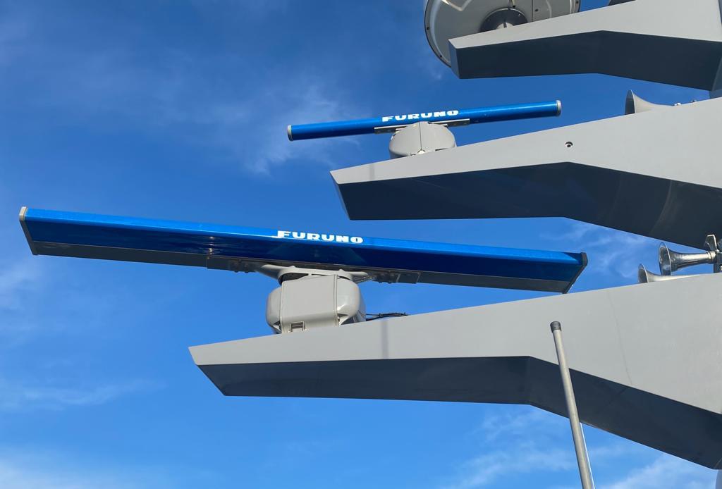
Traditionally, ships at sea have been outfitted with marine radars that utilize magnetrons to produce radio waves. Recently, however, there has been a global shift towards solid-state technology, where radars employ solid components like semiconductors to create radio waves. Furuno's advancement in solid-state technology and its practical application have introduced even more distinctive features, promising to provide increasingly beneficial and innovative solutions.

ENHANCING NAVIGATION RADAR: SPECIALIZED SIGNAL PROCESSING FOR ADVANCED SOLUTIONS


By enhancing Furuno's navigation radar with advanced signal processing, we aim to effectively utilize our technology to clearly display echoes. Our innovative and cost-effective solutions address the growing need to detect specific objects, such as sea ice cracks or oil slicks.

Shape


Weather Radar

Shape


Oil Radar

Shape


Ice Radar

Shape


Wave Analyzer

Meteorological & Observation System

WEATHER RADAR


Furuno, leader in marine radar development, collaborated with universities to create advanced radar solutions for meteorological monitoring, enhancing safety through detailed forecasts of localized weather disturbances and hazards.


Go to Products
Solutions Detail Page - Meteo & Object Monitoring row 6

The world's smallest and lightest weather radar

Drawing on its knowledge in maritime technology, miniaturization, and solid-state physics, Furuno has created one of the lightest and most compact Doppler weather radars in the world.


Unlike traditional large-scale systems, Furuno's compact weather radar can be installed in hard-to-reach locations, such as the rooftops of tall buildings or mountainous regions. By detecting raindrops early within cumulonimbus clouds and low-level clouds that are too low for large-scale meteorological radars, we can develop more effective alert systems for torrential rains and tornadoes.

img_solution02_en
top_ph2_en

Numerous fields of application

Furuno's latest weather radars are small and can be effortlessly mounted on rooftops and mountain peaks, a feat unimaginable just a few years back. Their simple installation and portability offer versatility for numerous uses and applications. These radars deliver thorough disaster prevention solutions for any scenario.

A reliable and innovative meteorological solution to face unpredictable weather conditions


Furuno's Meteorological Monitoring and Analyzing System addresses two primary concerns for public and private institutions regarding weather threats: safety and operational efficiency. By providing accurate, real-time weather data, the system enhances safety by enabling timely decision-making to protect lives and property during severe weather events.

This is crucial for emergency services, transportation, and infrastructure management. Additionally, the system improves operational efficiency by allowing businesses to optimize their activities based on precise weather forecasts, minimizing disruptions and reducing costs. This dual focus ensures that institutions can effectively manage risks and maintain continuity in the face of unpredictable weather conditions.

Chief Engineer

Applied System Engineering Section, Research & Development Department

at Furuno


"Our weather radars are compact, lightweight, and easy to install and transport, making it possible to install them in mountainous areas, remote islands, and other areas where conventional large weather radars are difficult to install. In addition, by constructing a multi-radar system using multiple weather radars, it is possible to complement each other's observation areas that would otherwise be missed by a single weather radar. Furthermore, the radars are cost-competitive and have been introduced to least developed countries, local governments, research institutes, and private companies that have been unable to introduce weather radar systems in the past. It is used not only to support transportation infrastructure and sewage systems through high-precision weather observation, but also for research and studies for a wide range of purposes, including volcanic eruption monitoring and wildfires."

Two radar models to fulfill various weather monitoring needs

lineup_image_en


Furuno developped two X-band weather Doppler radars: the WR110, which is single polarimetric, and the WR2120, which is dual polarimetric.

The WR110 is highly effective for standard rain monitoring, while the WR2120 offers advanced capabilities, such as three-dimensional analysis of intense precipitation from cumulonimbus clouds and predicting localized rainfall.

By integrating multiple WR2120 and WR110 Radars into a multi-radar system, it is possible to achieve real-time 3D monitoring of weather phenomena with a cost-effective investment.


KEY BENEFITS OF FURUNO'S WEATHER RADARS

KEY BENEFITS WEATHER RADAR
Shape

Compact, lightweight and solid-state

Our weather radars employ solid-state technology, which lowers both operating and maintenance expenses due to its low power usage and reduced need for replacement parts. Additionally, this technology offers precise precipitation monitoring with extensive signal processing and data format options.

Shape

Simple and quick installation

Our weather radar does not require heavy machinery for transportation or installation. A team of two people can easily set it up. It operates on a standard AC power outlet, similar to those used for household appliances (100V/200V). The radar can be installed almost anywhere without the need for special structures or configurations.

Shape

Safe relocation, easy transportation

A variety of transportation choices can be used including pickup, trailer, and small trucks. Optional heading sensor for azimuth adjustment, vibration isolator for secure relocation and transport and case are available for convenient transportation.

Shape

Used for large radar (S/C-band) supplement

Furuno X-band radars can enhance, support, and cover areas that other global weather surveillance radars are unable to reach.

Shape

Multi-radar system for wide areas and blind area coverage

Expanding the number of radars allows for broader area coverage. Additionally, when radars are deployed in the same location, their observational data can be integrated, which enhances accuracy and offers vector Doppler velocities along with improved three-dimensional imaging.

Shape

Various data format compatibilities

The following data formats are available for major software packages such as Baron Lynx and Vaisala IRIS Focus: CF/Radial, Opera Odim HDF5, CF-compliant NetCDF (rain only) Grib2 (rain only).

Furuno Weather Radar Presentation


Furuno Technology


Meteorological & Observation System

OIL RADAR


Furuno's Oil Radar solution FOIL-200 was created to help safeguard the environment and marine life by identifying oil spills on the ocean's surface.


Go to Products
img_detect04

Fundamentals of Oil Radar

img_detect04

The strength of a reflected wave is influenced by the wave's height. Because oil is more viscous than seawater, an oil-covered surface makes it more difficult for radio waves to be effectively reflected. 

Consequently, radar signals appear weaker. Furuno Oil Radars employ a specialized algorithm to clearly display these areas. Surfaces affected by oil spills are automatically detected and shown on the monitor.

FOIL-200 oil spill detection radar is compatible with standard Furuno FAR-15x8, FAR-2xx7, FAR-2xx8 or FAR-3000, FAR-3005 X-band navigation radar.

ss_ph01

The image combines navigation and oil radar data, with green echoes representing the navigation radar and the remaining visuals depicting the oil radar picture.

ss_ph02

Bright echoes are other vessels with dark shadow areas trailing them. The dark area depicted on the right side of the heading line indicates an oil spill.

ss_ph03

The user has marked a green polygon.

ss_ph04

An oil spill appears as a dark, no-echo area on the screen.

KEY BENEFITS FROM FURUNO'S OIL RADAR SOLUTION

KEY BENEFITS FOIL RADAR
Shape

Comprehensive Oil Detection for Marine and Land Applications

Our advanced oil spill detection system integrates seamlessly with standard navigation radar, making it suitable for both offshore and onshore environments. It can be installed on vessels, oil rigs, or any platform requiring precise oil spill monitoring.

Shape

Efficient Spill Identification and Documentation
The system automatically identifies oil spills and outlines them with polygons for easy visualization. Users can also manually adjust these markers and update them as needed. For documentation and training, screenshots and raw radar video recordings can be saved to external storage devices.

Shape

Advanced Video Processing and Analysis

The FOIL-200 system leverages raw radar video from navigation systems, employing a sophisticated algorithm to detect oil spills effectively. Users can switch between various Fusion modes to optimize image clarity and view results in real-time. The system generates detailed images by integrating multiple radar scans, using motion-compensated Fusion techniques. Adjustments to the Fusion Scan number and mode enhance detection accuracy.

Furuno Oil Radar Presentation


Interconnection Diagram

diagram-1

Meteorological & Observation System

ICE RADAR


While traveling in the North Pole, where the sea is blanketed with ice, icebreakers and ice-class ships with strong ice resistance are essential. To ensure these vessels can travel safely and effectively, identifying a path through the thinnest ice is vital. 

This led to the creation of our Ice Radar FICE-100 —a genuine navigation radar solution that enhances the visibility of ice cracks like never before.


Go to Products
SECTION FUNDAMENTALS FICE

Fundamentals of ice Radar

SECTION FUNDAMENTALS FICE

Furuno's Ice Radar leverages the principle of refractivity to enhance navigation in icy waters. When radio waves hit unbroken ice, they are typically reflected back weakly to the antenna. However, when the ice is cracked or uneven, the waves scatter, resulting in a stronger signal. 

This radar solution is specifically engineered to accurately display echoes from these broken ice areas, enabling users to quickly and intuitively determine optimal routes. Additionally, Furuno's advanced signal processing capabilities allow the radar to double as a navigation tool, ensuring safe and efficient travel through icy conditions.

FICE-100 ice detection radar is compatible with standard Furuno FAR-15x8, FAR-2xx7, FAR-2xx8 or FAR-3000, FAR-3005 X-band navigation radar.

ss_ph01s

View of the harbor, illustrating the departure routes from the port and the damaged section of the port.

ss_ph02s

Challenging ice conditions revealing the three ancient fractured ice channels. Enlarged view.

ss_ph03s

A distinct ice channel broken in the direction of 228.8 degrees.

KEY BENEFITS of FURUNO'S ICE RADAR SOLUTION

Solutions Detail Page - Aquaculture Solution row 25
Shape

Enhance safety
-Visualizes ice structures
-Identifies the optimum route through ice
-Displays the route in poor visibility
-Detects ice up to 3 nautical miles away
-Ice radar stabilizes the ice image compared to navigation radar using advanced algorithms.

Shape

Ice radar presents ice conditions
The FICE-100 reduces image noise, making the intricate ice structures more visible. The hybrid ice radar captures the raw radar signal from the ARPA processor. The outcome is a stable image that reveals the fine details in the radar echoes.

Shape

Reduced power usage
By utilizing ice radar, vessels can locate old rifts, clear ice, and channels created by icebreakers and other ships. By finding and using these, the vessel consumes significantly less power, saving fuel and time!

Shape

An alternative to an infrared camera
Infrared cameras are difficult to maintain in icy conditions. Ice radar acts as a supplementary system to navigation radar for observing ice conditions using the same outdoor equipment.

Furuno ice Radar Presentation


Interconnection Diagram

diagram (1)


Furuno Technology


Meteorological & Observation System

WAVE ANALYZER


Furuno's Wave Analyzer WV-100 provides real-time monitoring and analysis of wave echoes to enhance maritime safety, even during nighttime operations. Furthermore, it facilitates data sharing between ship and shore, as well as among vessels, enabling swift adjustments, cost-effective route planning, and efficient traffic management in port areas where monitoring sea conditions is crucial for ensuring the safety of all ships.

The Wave Analyzer radar WV-100 is compatible with FAR-2xx8 and FAR-3xx0 navigation radars.


Go to Products
Solutions Detail Page - Aquaculture Solution row 29 (1)
wv100_ft_01

Wave Analyzer

World's First Wave Analyzer/S-band antenna compatibility.

Display wave data on the radar monitor

The information can be displayed on both the PC screen and the radar screen.

wv100_ft_03

Automatic Adjustment Feature


For the first time, a wave analyzer solution includes an automatic adjustment feature that eliminates the need for users to calibrate the device after installation. Additionally, sudden changes in sea conditions have minimal impact, ensuring the wave data remains accurate and reliable.

Real-Time Wave Data Output


Data can be transmitted in real-time to any compatible external system, such as automated weather reporting systems or dynamic positioning systems, via serial transmission.

Displays wave data, echo, and system information on a PC monitor

The information can be displayed on both the PC screen and the radar screen.

Significant wave height

The significant wave height is a statistical value obtained by averaging the height of the one-third highest waves when observing the specified area.

[1st Wave] [2nd Wave]

Among the observed waves, the two most outstanding waves are selected and assigned as [1st Wave] and [2nd Wave] for reference. There is no distinction made between wind waves and swells for this selection.

Radar information (Display order)

Antenna ID, Band width, Transceiver type
Pulse width
Display range.

Camera Icon

Takes a screenshot.

System information box (Display order)

Shown in the sea-trial mode.(No indication in the normal mode.)
Shown in yellow when setting the wave height analyzing mode to Manual. (No indication for Auto mode.)
Programing version NO. this software.

Alert information box

Click the alert icon to display the [Alert Status] screen.

wv100_display_01_en
wv100_display_02_en

Wave spectrum display


The color of the wave spectrum indicates the relative intensity of the wave spectrum display.

wv100_display_03_en

Radar echo display


The radar reflection's absolute intensity from the wave escalates in the sequence of dark blue, light blue, light green, dark green, orange, yellow, and red.

KEY BENEFITS FROM FURUNO'S WAVE ANALYZER SOLUTION

KEY BENEFITS WAVE ANALYZER
Shape

Enhanced Safety and Navigation
Utilizing a wave analyzer solution by Furuno significantly enhances maritime safety and navigation. By providing real-time data on wave height, direction, and frequency, it allows vessels to make informed decisions, avoiding hazardous conditions and optimizing routes for smoother and safer voyages.

Shape

Optimized Fuel Efficiency
With precise wave analysis, vessels can adjust their speed and course to minimize resistance and maximize fuel efficiency. Furuno's wave analyzer helps in identifying the most energy-efficient paths, reducing fuel consumption and operational costs, which is crucial for both economic and environmental sustainability.

Shape

Improved Operational Planning
Furuno's wave analyzer solution offers valuable insights for better operational planning. By understanding wave patterns and trends, maritime operators can schedule activities such as loading and unloading, maintenance, and crew shifts more effectively, ensuring operations are conducted under optimal conditions and reducing downtime.

Furuno Wave Analyzer  Presentation


Interconnection Diagram

wv100_Diagram_img_001_en
Catalogue 2

ESSENTIAL DOWNLOADS


Here you can find all relevant information about this topic.


Contact us for all inquiries regarding our Meteorological & OBSERVATION Systems.