


SOFTWARE
TZ NAVIGATOR
The recreational software that fits all types of marine navigation !
TZ NAVIGATOR is intuitive marine navigation TIMEZERO software for recreational boaters, offering chart plotting, weather forecasts, AIS, and full integration with FURUNO systems.
REF.: MAX-TZNAV
TZ NAVIGATOR


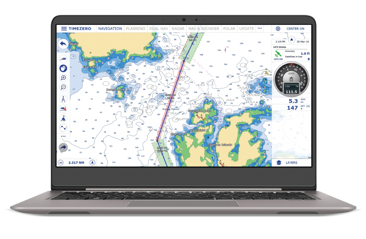
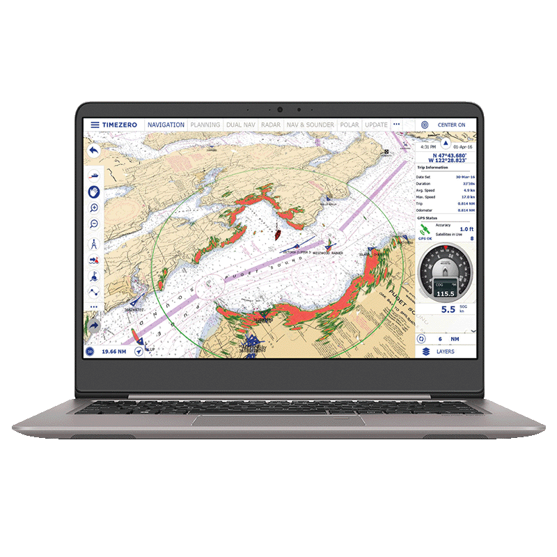
TIMEZERO 2D/3D Seamless Chart Engine
The exclusive TIMEZERO Chart Engine offers seamless 2D and 3D chart display with no redraw time, and integrates PhotoFusion to merge high-resolution satellite imagery with raster or vector nautical charts. Land areas are rendered from satellite photos, while deeper waters reveal underlying chart layers in a smooth, continuous view—ensuring high clarity and superior situational awareness on a single screen.
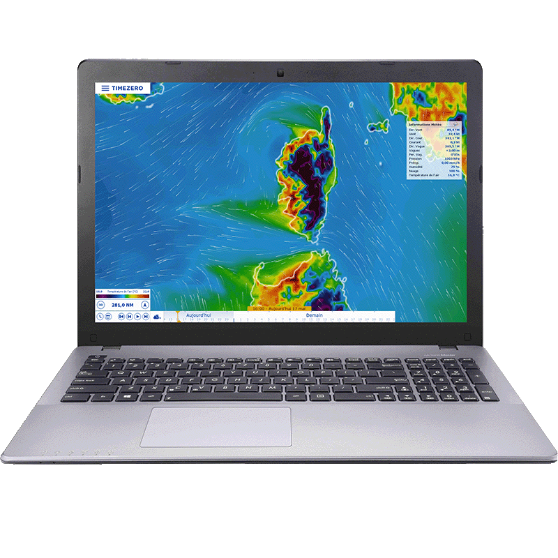
Weather & Tide Data for Navigation
TZ Navigator empowers navigators with global tide and tidal-current data and a free worldwide weather-forecast service offering up to 15 days of download-ready data (wind, gusts, pressure, waves, surface currents) at 0.25° resolution. Marine and ocean data layers integrate directly on the chart for intuitive overlay and visualization of evolving meteorological and oceanographic conditions, enabling better departure-time decisions, safer passage planning and full situational awareness in recreational or coastal navigation.

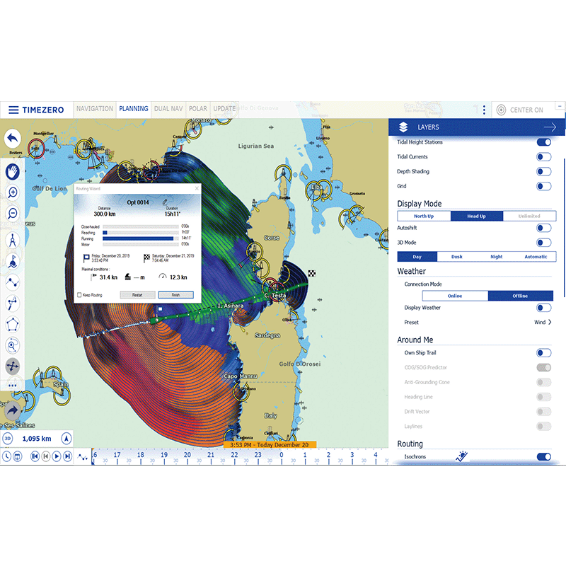
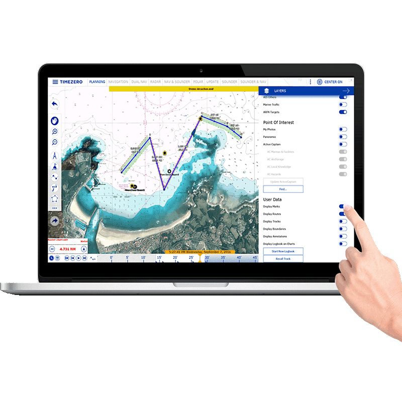
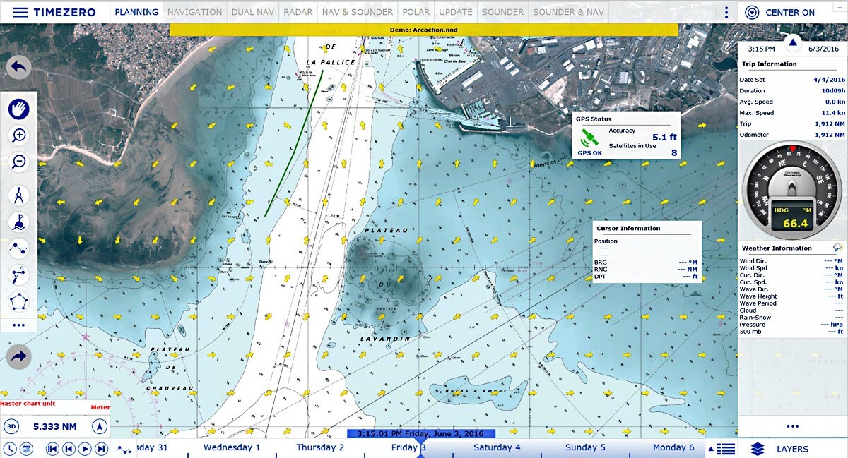
Advanced Route Planning Tools
The Route Planning Wizard in TZ Navigator helps users determine optimal departure and arrival times by considering tides, currents and estimated transit time. The safety-check display highlights each route leg with colour codes to indicate whether depth is sufficient for the vessel, making it easier to plan safe, accurate and tide-aware passages.
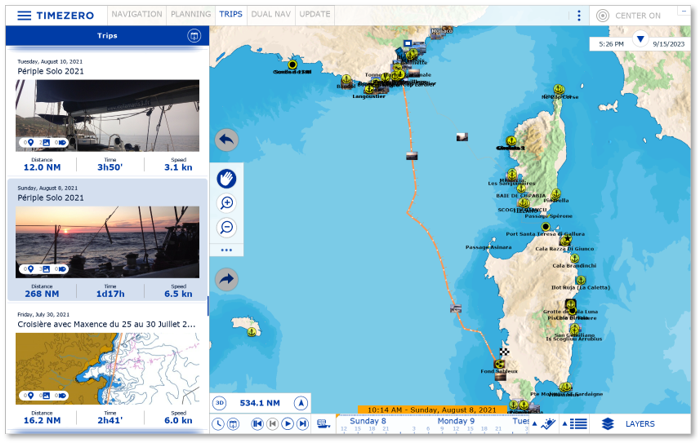
Trip Logs and Navigation History
The Trips feature in TZ Navigator allows you to view and manage all your past outings in a clear, organized interface. Each trip groups your recorded track and associated navigation data, making it easy to review where you sailed, analyse your navigation history and keep an accessible log of your time on the water. This helps users quickly revisit previous routes, understand conditions encountered, and prepare future outings with greater confidence.
Interface
The user interface of TZ NAVIGATOR is designed for ultimate simplicity and control, featuring an intuitive layout fully adapted for touchscreen use. Day, dusk and night modes ensure optimal visibility in all conditions. With one click you switch between workspaces and access powerful tools, while Quick-Action NavData buttons allow fast custom actions for a tailored navigation workflow. This interface puts critical navigation controls at your fingertips for safer, smoother journeys.
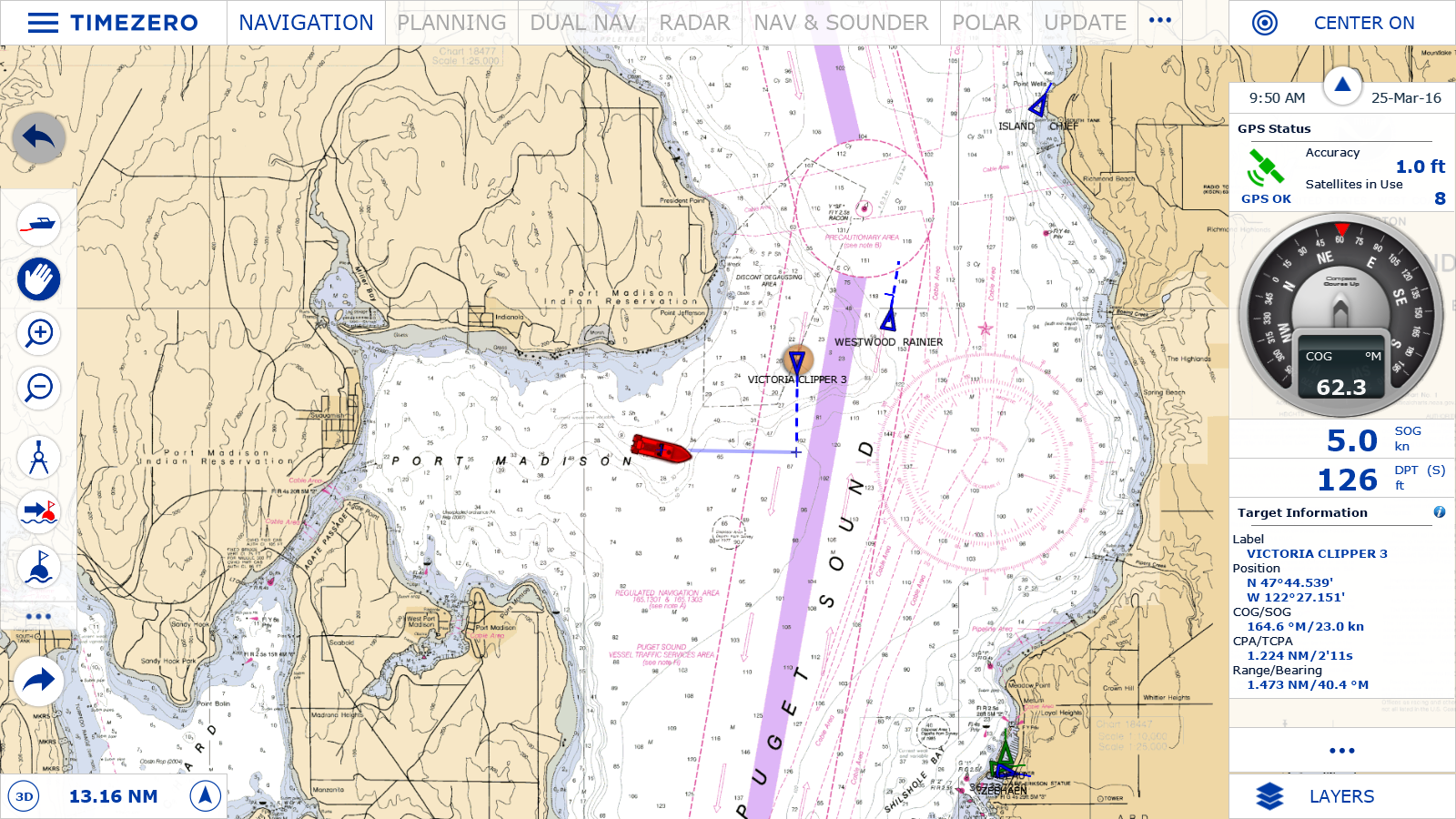
AIS/ARPA Target Display & Management
The AIS/ARPA feature in TZ NAVIGATOR lets you receive and display AIS and ARPA target data directly in the chart area and view a full targets list with all pertinent information. You can record unlimited AIS/ARPA tracks, set customizable CPA/TCPA alarms and manually manage anti-collision settings. This ensures enhanced awareness of nearby vessel movements and helps prevent collision risks in busy navigation zones.
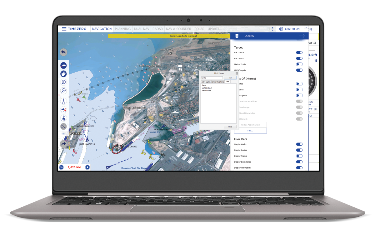
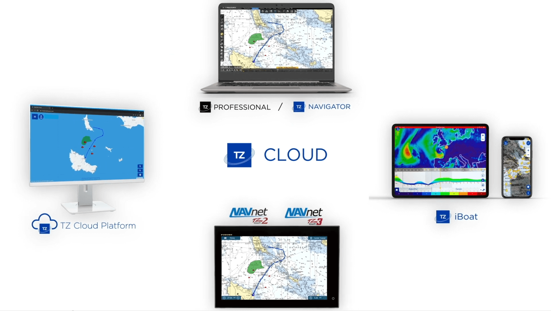
TZ Cloud Multi-Platform Sync
TZ Cloud provides secure, real-time synchronization of navigation data between TZ NAVIGATOR, other TIMEZERO platforms and FURUNO NavNet TZtouch MFDs. Marks, routes, boundaries and user objects are automatically backed up online, protecting your data from loss and making it available across all connected devices whether you are on board, at home or on the move.
Security Cone Navigation Safety
The Security Cone in TZ Navigator provides a clear visual indication of the safe depth ahead of your vessel based on your boat’s draught. As you move, the cone highlights areas that may be too shallow, allowing you to immediately spot potential grounding risks directly on the chart. This simple and intuitive tool helps you maintain safer navigation by giving you a real-time view of under-keel safety along your course.
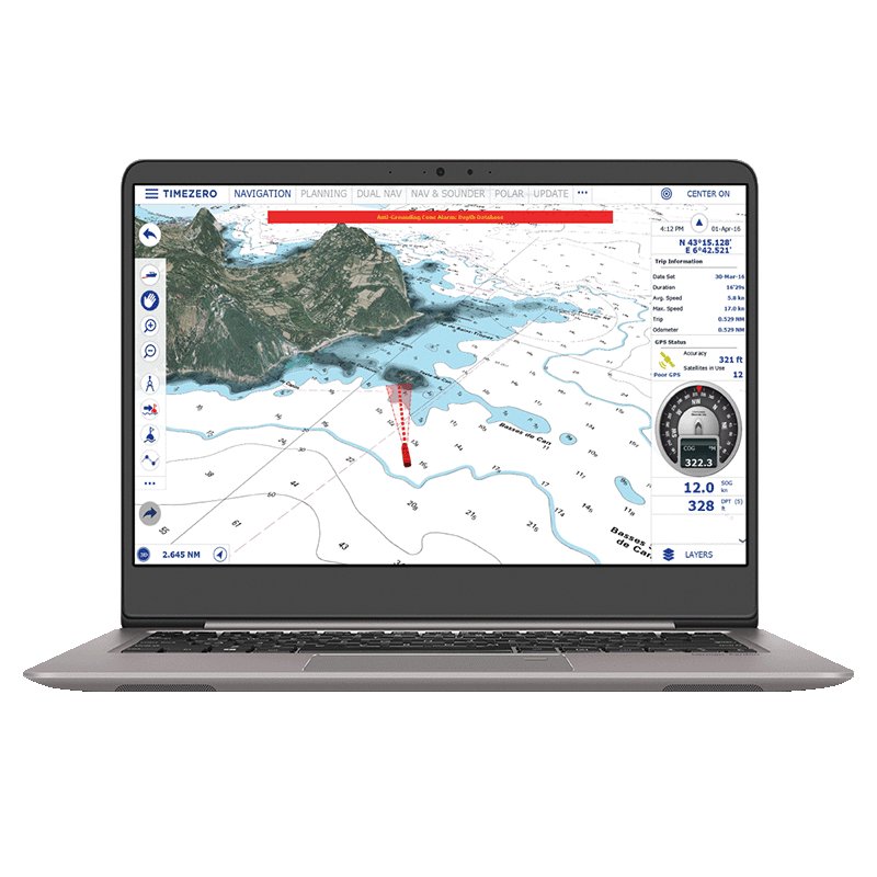
Odometer Speed & Distance Data
The Odometer NavData in TZ Navigator automatically displays your trip information, including duration, distance, maximum speed and average speed. By giving you a clear overview of your navigation activity, it helps you better understand your vessel’s use and supports safer decision-making on the water, contributing to increased safety onboard during every outing.
FURUNO Native Compatibility
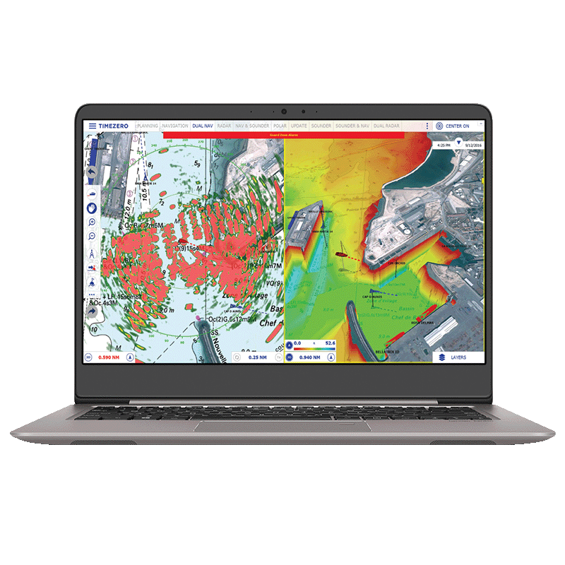
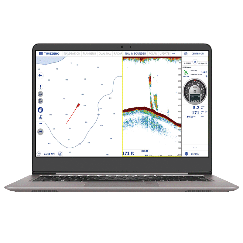
TZ NAVIGATOR offers native compatibility with FURUNO systems—connect via Ethernet to NavNet, radar (DRS/FAR series) and black-box Ethernet sounders. This allows you to overlay radar or sounder data on your charts, share navigation information across platforms and tap into a fully integrated ecosystem for enhanced situational awareness and system control.
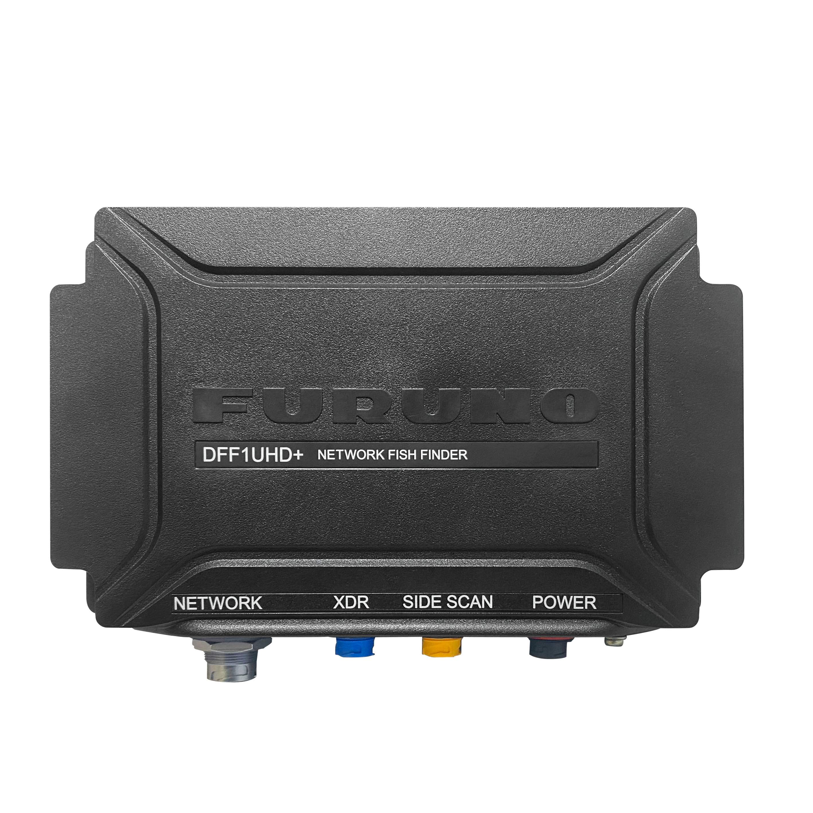
TIMEZERO now fully compatible with Furuno DFF1‑UHD+
TIMEZERO (from version 5.4) brings full support for the new Furuno DFF1‑UHD+, delivering ultra‑high‑definition sonar, improved target separation, and detailed seabed imaging across TZ Professional and TZ Navigator.
Download all the necessary documents

Product Advantages
Versatile Navigation: Designed for all types of recreational sailing—from relaxed cruising to competitive regattas.
Cutting-Edge Technology: Advanced features ensure safe, efficient, and enjoyable navigation.
Core Benefits: Delivers supreme control and unmatched comfort at sea.
Intuitive Interface: Fully optimized for touch screens, making route planning effortless.
Enhanced Safety: AIS and ARPA target tracking for collision avoidance.
Smart Route Planning: Advanced routing tools for precise itinerary management.
Furuno Integration: Direct Ethernet connection to NavNet systems for radar overlay, waypoints, and route control.
Premium Weather Access: Accurate forecasts for better decision-making.
Expandable Modules: Radar, sounder, object display, and seafloor data for a complete navigation experience.
TIMEZERO (from version 5.4) now fully compatible with Furuno DFF1‑UHD+
Cloud Synchronization: Seamless data backup and multi-device access.
In the box
TZ Navigator PC software comes with 2 workstations + integrates with the whole TIMEZERO ecosystem including TZ MAPS, TZ iBOAT, TZ CLOUD, and Furuno NavNet system.