.png?width=300&height=46&name=info.furuno.iths-fshubfsLOGOSCorporate%20Color%20Display(Reverse).png "Furuno Hellas")
 en
en

FISH FINDER
Model TZTE
Scalable Integration with Serious Capability!
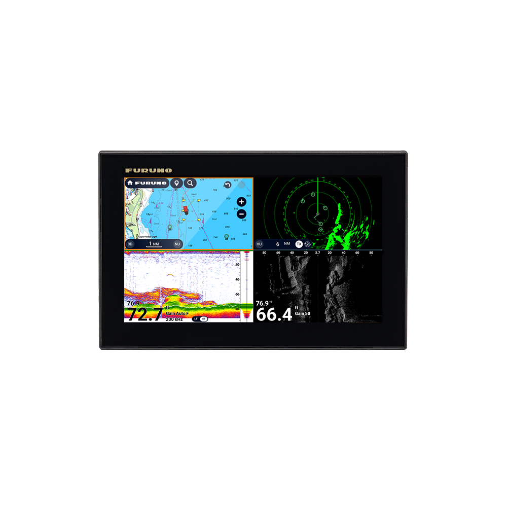
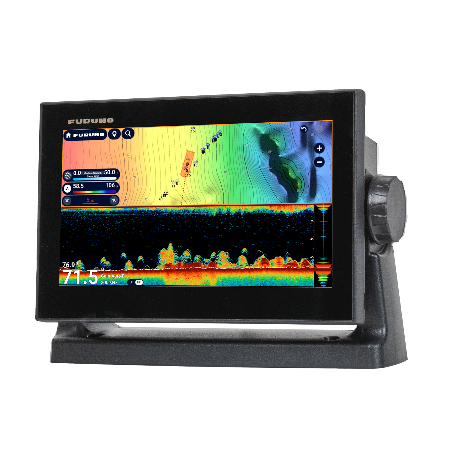
TZTE is a Networkable 9” and 13” TZtouchE multi-touch multifunction display with color LCD display, supporting TZ MAPS and multiple chart formats, built-in CW and CHIRP sonar (including Side-Scan), and 12/24 V operation for scalable NavNet integration.


Scalable Integration with Serious Capability
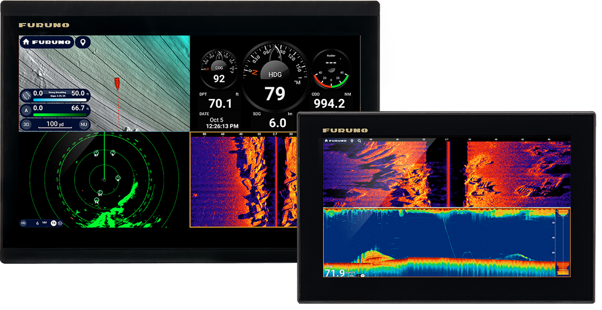
The NavNet TZtouchE Series is designed to deliver high-level performance with true system scalability, making it suitable for vessels of any size. Available in 9” and 13”, the TZT9E and TZT13E operate as fully networkable multifunction displays that extend well beyond stand-alone navigation. With comprehensive radar compatibility, expandable sonar functions, and seamless integration of cameras, IP devices and onboard sensors, these displays form a solid foundation for an evolving NavNet installation. Standard support for TruEcho™ CHIRP Fish Finder, CHIRP Side-Scan, and TZ MAPS provides a complete navigation and fishing solution within a compact, streamlined design.
Whether configuring a new helm or enhancing an existing NavNet network, the TZtouchE multi-touch displays deliver advanced charting, radar, fish finder and video integration, all powered by the intuitive NavNet TZtouchXL platform developed by Furuno.
Effortless control
The NavNet TZtouchXL interface has been designed to make everyday navigation fast, clear and intuitive, even in demanding conditions. Familiar touch gestures allow users to interact naturally with the system, while edge-swipe controls and direct-access menus ensure that key functions are always within easy reach. The result is a fluid user experience that minimizes interaction time and maximizes situational awareness at the helm.
By combining a clean interface with powerful processing, the NavNet TZtouchE series allows navigators to control charting, radar, sonar and connected equipment with confidence and precision. The simplicity of operation does not limit capability—on the contrary, it ensures that advanced functions remain easily accessible whenever they are needed, reinforcing Furuno’s focus on safe and efficient navigation.
See More with TZ MAPS
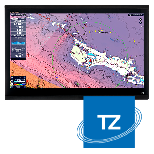
TZ MAPS gives navigators full control over the chart data they use on board, from wide-area coverage to satellite imagery and high-resolution bathymetry. Chart regions can be selected and purchased directly from the multifunction display, allowing users to tailor their navigation environment to their cruising or fishing area. Advanced depth color shading combined with bathymetric overlays delivers highly detailed and readable charts, with multiple color themes available to suit different operating conditions.
Users can also create and manage custom objects, or update existing charted elements such as buoys and markers when their positions change. These user-defined objects can be shared with the wider TZ MAPS community via a moderated service and easily enabled or disabled through the Layers menu using a simple edge-swipe gesture. Unlocking any TZ MAPS region also enables advanced functions such as AI Routing, which calculates routes by taking vessel draft, charted depths and navigational hazards into account.
In addition, purchased TZ MAPS charts are automatically available in the free TZ iBoat mobile application, providing an efficient home-planning solution for route and waypoint preparation. With a free TimeZero account, navigation data can be securely backed up to the cloud and restored at any time, ensuring valuable routes and waypoints remain protected and accessible across devices.
Total Control
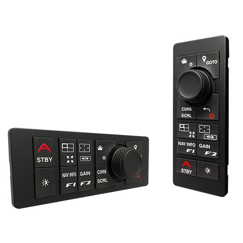
For operators seeking enhanced tactile control, the MCU-006 and MCU-006H remote control units provide an efficient alternative to touch-only operation. Available in vertical or horizontal formats, these controllers can operate any NavNet TZtouchXL multifunction display connected to the network, offering flexible installation options to suit different helm layouts.
Each unit features a responsive RotoKey™ combined with ten programmable dual-function keys, allowing quick access to commonly used functions. Edge-swipe actions and key system commands can be activated directly from the controller, enabling precise and confident operation in challenging sea conditions, while reinforcing Furuno’s focus on intuitive and professional helm control.
Find Your Safe Anchorage with Dynamic Mooring
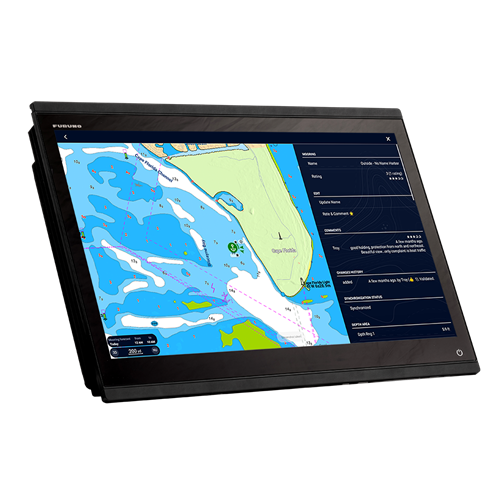
Dynamic Mooring assists navigators in selecting suitable anchorage areas by combining weather forecast data with the detailed chart information available through TZ MAPS. Once the relevant forecast is downloaded and a date selected, the system automatically evaluates expected wind conditions in relation to surrounding landforms and seabed features to assess the level of protection at each anchorage.
Anchorage zones are presented using a clear, color-coded status—green for well protected, orange for partially sheltered, and red for exposed—allowing users to make informed decisions at a glance. These locations are derived from high-resolution vector charts and further enriched by contributions from the TimeZero Community Maps network, helping to maintain a current and comprehensive anchorage database for practical, real-world use.
Experience Ultra-Detailed Bathymetry with BathyVision
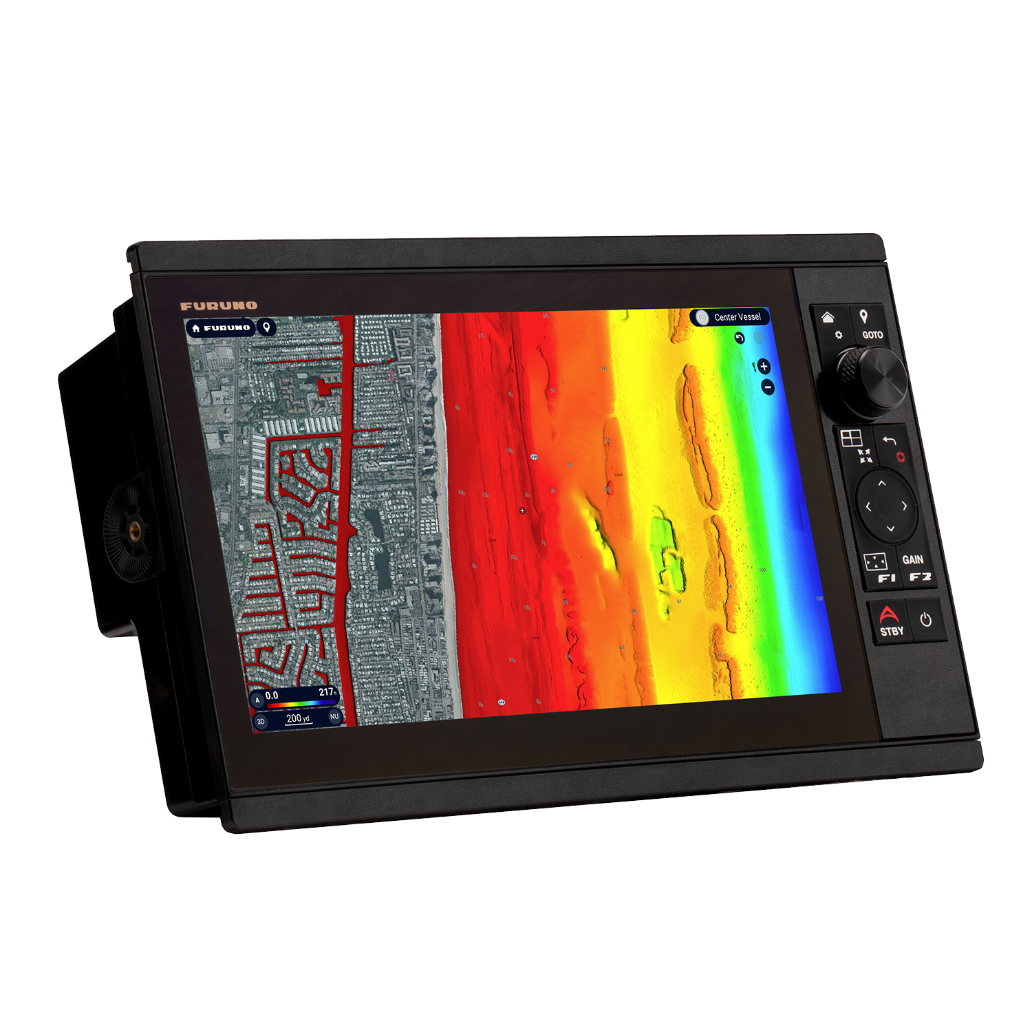
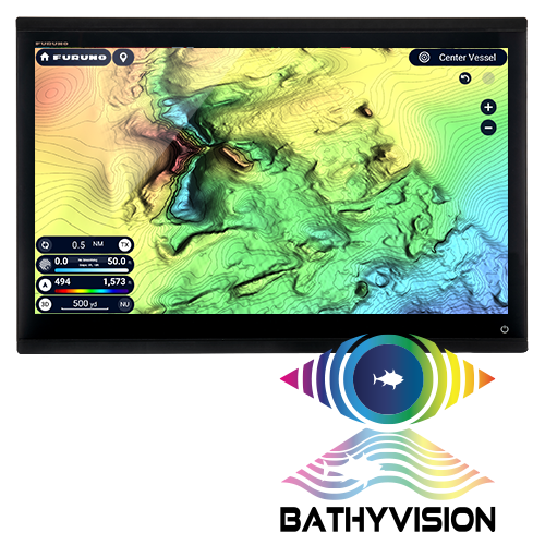
BathyVision, available with TZ MAPS, delivers exceptionally precise bathymetric information with contour intervals that can be adjusted instantly to match the navigator’s needs. These finely resolved contours—down to very small depth increments—provide a level of seabed definition that exceeds conventional bathymetric charting, offering greater confidence when navigating or fishing in complex underwater environments.
The bathymetric data is generated from the same high-resolution database used for TZ MAPS depth shading and can be overlaid directly onto standard navigation charts. This combination creates a clear and informative representation of seabed structure, allowing users to better identify depth changes, slopes and underwater features, and to build highly effective fishing or navigation charts tailored to their operating area.
The benchmark for radar
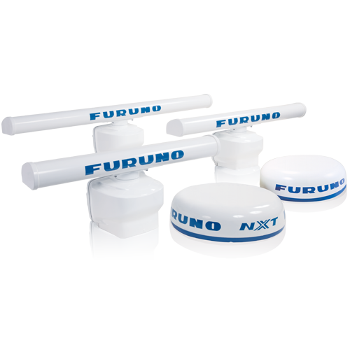
Reliable radar performance is essential for safe navigation, whatever your activity at sea. The TZtouchE series is fully compatible with the complete range of Furuno radar sensors, from proven X-Class magnetron radars to advanced NXT solid-state Doppler models. This flexibility allows operators to select the radar technology best suited to their vessel and operating profile, while benefiting from consistently high target definition and long-term reliability.
From compact dome antennas to high-power open-array radars, Furuno radar solutions provide a wide range of advanced functions designed to enhance situational awareness. Features such as Target Analyzer™ help identify potentially hazardous targets, while Fast Target Tracking rapidly displays course and speed vectors. Dedicated modes including Bird Mode and Rain Mode further improve target detection in demanding conditions, whether tracking seabirds offshore or navigating through heavy precipitation. When combined with the TZtouchXL platform, additional tools such as Risk Visualizer™ and AI Avoidance Route™ contribute to safer route planning and confident decision-making on the water.
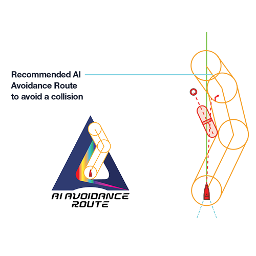
Risk Visualizer™ and AI Avoidance Route™
Risk Visualizer™ enhances collision awareness by providing a clear, graphical representation of potential risks detected by the radar around the vessel. Instead of focusing solely on targets along the current course, the system continuously evaluates surrounding traffic through a full 360° analysis, identifying objects with the highest likelihood of close-quarters situations. These targets are highlighted using dynamic visual indicators, helping the operator maintain safe passing distances and improved situational awareness.
When combined with TZ MAPS, AI Avoidance Route™ uses radar data together with chart information to automatically calculate an alternative route around identified hazards. This intelligent routing function supports safer navigation decisions by quickly proposing a practical avoidance path, particularly in congested or restricted waters.
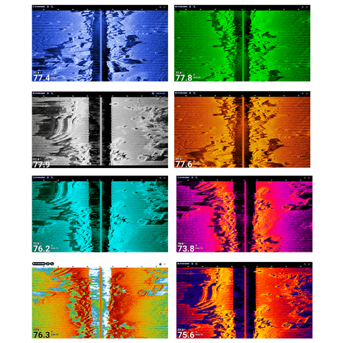
Built-In CHIRP Side-Scan
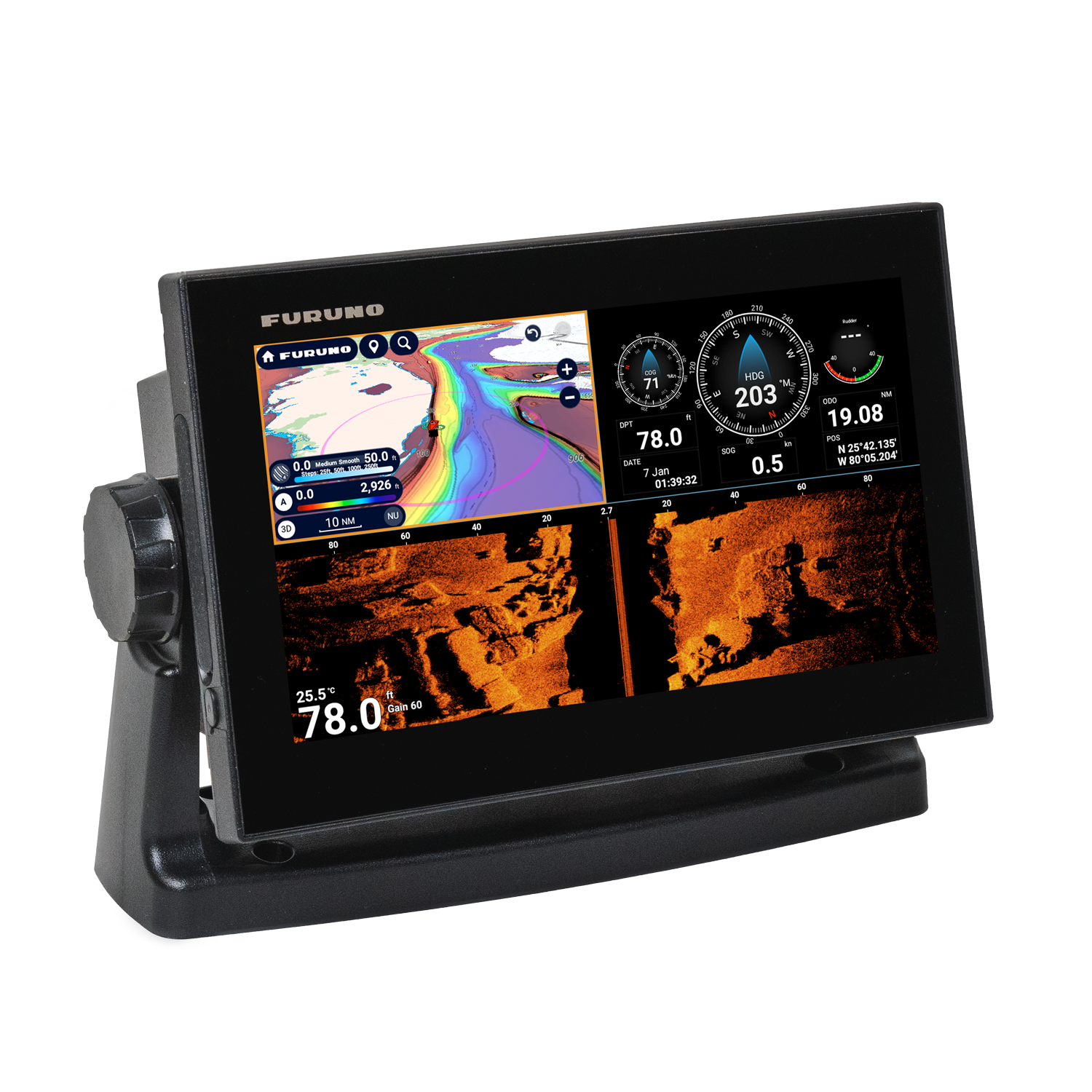
The integrated CHIRP Side-Scan technology provides detailed port and starboard imaging, allowing users to clearly visualize seabed structure and fish-holding features alongside the vessel. By delivering high-definition side-looking sonar views, the system helps distinguish fish targets from surrounding structures and improves interpretation of underwater environments in a wide range of fishing and navigation scenarios.
Operating at 230 kHz or 455 kHz CHIRP centre frequencies, the system supports various transducer installation options, including thru-hull, paired and transom-mount configurations. Built directly into compatible TZtouchXL displays, CHIRP Side-Scan data can be viewed from any MFD connected to the network, ensuring flexible access across the helm. Multiple colour presentation modes are available, ranging from classic palettes to high-contrast options, allowing users to optimise visibility according to conditions and personal preference, in line with Furuno’s focus on clarity and performance.
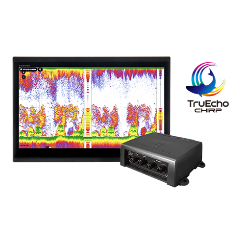
A High-Performance Platform for Serious Anglers
The NavNet TZtouchE series has been developed to meet the demands of dedicated sportfishing users, combining powerful sonar performance with flexible system configuration. Each display includes an integrated TruEcho™ Fish Finder supporting 300 W, 600 W or 1 kW output, operating in CW or CHIRP modes, along with built-in CHIRP Side-Scan at 230 kHz or 455 kHz for detailed imaging of fish targets and bottom structure on both sides of the vessel.
In addition to its internal sonar capabilities, the system provides full control of compatible Fish Finders connected via the NavNet network. This allows anglers to customise their setup with a wide selection of high-power sonar modules, making the NavNet TZtouchE series well suited for advanced applications such as deep dropping and offshore fishing, while maintaining seamless integration across the helm through the NavNet TZtouchXL platform by Furuno.
See Your Surroundings in a New Way with the CSH10 Omni Sonar
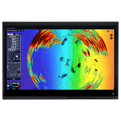
The CSH10 360° Scanning Sonar integrates seamlessly with the NavNet TZtouchXL platform, providing full control and native operation from the multifunction display. Once connected, the sonar is automatically detected as a system sensor, enabling a dedicated sonar display without additional configuration. Operators can directly adjust key parameters such as tilt and gain, monitor operating status, and create event marks to track and revisit significant underwater targets.
Thanks to Sonar Overlay technology, real-time sonar echoes can be displayed directly on the navigation chart. This combined view allows users to clearly understand the position of fish targets in relation to charted features, seabed structure and underwater topography. By visualising sonar data alongside wrecks, reefs, drop-offs and other key features, situational awareness is significantly enhanced, supporting more informed decisions during both fishing operations and navigation in complex environments, in line with Furuno’s integrated system approach.
Never Lose Waypoints, Routes or Settings with TZ Cloud
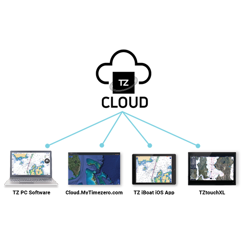
TZ Cloud ensures continuity between onboard navigation and home planning by securely synchronising user data across compatible TimeZero applications. Routes and waypoints can be prepared ashore using TZ Navigator, a standard web browser or the TZ iBoat iOS app, then transferred seamlessly to the NavNet TZtouchXL multifunction display via the cloud. Navigation data created on board can likewise be backed up automatically and accessed remotely, providing peace of mind and data security.
The cloud service stores key navigation elements including marks, routes, boundaries, photos and recorded fishing data. With a free TimeZero account, this information can be restored quickly whenever needed. In addition, the purchase of any TZ MAPS chart directly from the MFD unlocks the same chart coverage within the TZ iBoat mobile app and TZ Pro navigation software, enabling efficient route planning and data management across devices while maintaining a consistent navigation environment powered by Furuno.
-
TZT9E-J
(IMD09025DAA)
The TZT9E is a 9-inch networkable multi-touch multifunction display with integrated CHIRP fish finder, Side-Scan sonar and advanced TZ MAPS navigation features.
-
TZT13E-J
(IMD09026DAA)
The TZT13E is a 13-inch networkable multi-touch multifunction display with integrated CHIRP fish finder, Side-Scan sonar and advanced TZ MAPS navigation features.
Download all the necessary documents